Super El Niño charging ‘full steam ahead,’ potentially drenching California like never before
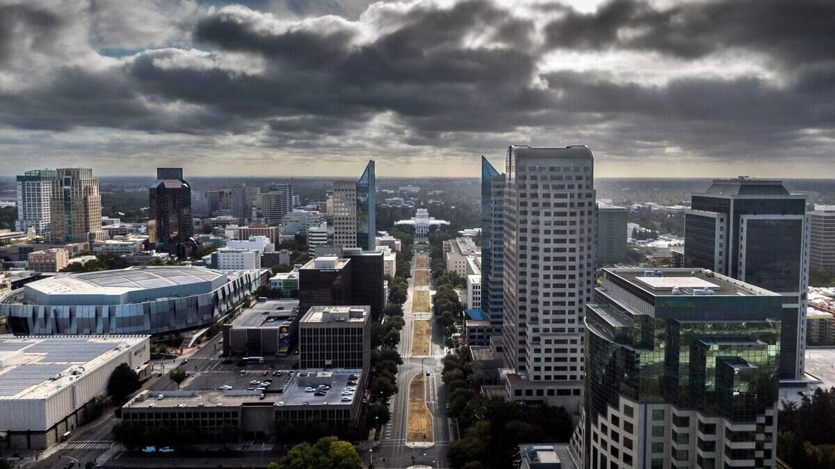
El Niño is back, and it might be bigger than ever.
The National Oceanic and Atmospheric Administration declared in June that the threshold for an El Niño had been met in the eastern Pacific Ocean, and that it was likely to strengthen significantly through the end of the year — potentially becoming the strongest on record by a wide margin.
This oceanic pattern, which typically alters global weather, has in the past been associated with intense California flooding, increased wildfire risk and generally reshaped seasons across the American West. For a state coming off its warmest winter on record, the stakes are enormous.
Daniel Swain, a climate scientist with the California Institute of Water Resources, said this El Niño has no signs of slowing down.
“The observed trajectory is a little bit faster even than some of the already very aggressive forecasts from a few months ago,” Swain said. “All signs point to full steam ahead.”
For the rest of the world, it may be a preview of a new climate that is unfolding before our eyes. Even moderate El Niños temporarily warm global temperatures; a strong El Niño alongside the backdrop of climate change will likely push global heat records to new heights.
What is El Niño?
El Niño events typically develop in spring and summer, peak in intensity between October and February, and persist for nine to 12 months, though some have lingered for two years. They are one half of a larger climate cycle – the El Niño-Southern Oscillation, or ENSO – whose cool phase, La Niña, tends to bring drier weather to Southern California and wetter weather to the Pacific Northwest.
Why this El Niño could be historic
The current numbers coming out of the tropical Pacific are startling. The Oceanic Niño 3.4 Index – the sea surface temperatures in an area of the ocean along the equator south of Hawaii and the standard measure of El Niño intensity – have surged to +1.8 degrees Celsius as of early July, having climbed from +0.48 degrees Celsius in April. This alone would make it the fourth or fifth most intense El Niño over the past 40 years, with more expected strengthening on the way.
These sea surface temperatures are almost 3.5 standard deviations above average for this time of year – the equivalent of a once-in-4,000-year event under normal conditions. Meanwhile, the upper-ocean heat content fueling this event is nearly double what was observed at the same point during the development of the 2023 El Niño.
This is reflected in NOAA’s own forecast, where the most recent outputs peg the index rising to around an astounding +4 degrees Celsius — completely unprecedented in modern history. The prior strongest on record in 2015 was +2.75 degrees Celsius.
An El Niño of this magnitude is likely to produce more intense versions of its global climatic effects, and bring with it the risk of completely new climatic developments. Sailing into uncharted waters, worldwide weather patterns — wet or dry — may trend toward the extreme.
“We may still have an event that is at least in the top three or four we’ve ever observed historically, if not the single most intense, and that’s a big deal,” said Swain.
El Niño can temporarily warm global temperatures by around half a degree Celsius. When adding this atop human-induced climate change, which has warmed the Earth by around +1.5 degrees Celsius, the result could be global temperatures that break records set during the 2023-24 El Niño, which is the warmest period in recorded human history.
Those same warmer temperatures from climate change do contribute to El Niño’s own warming. For this reason, NOAA now considers a new metric known as the Relative Oceanic Niño Index, which accounts for the long-term warmer temperatures in the tropics. Even from this vantage point, current forecasts still point to an event that rivals the strongest ever.
What can a super El Niño mean for California?
For California, a very strong El Niño arriving atop record-warm ocean temperatures along the Pacific Coast means the stakes are compounded. Warmer storms. Higher snow lines. More rain at elevation with less snow. More intense atmospheric rivers carrying more moisture.
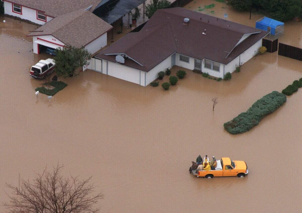
Rainy winters: The most well-known consequence of El Niño on California is a wetter-than-normal winter. When El Niño displaces the jet stream southward, it steers a parade of Pacific storms – including moisture-heavy atmospheric rivers – directly into the state. The strongest atmospheric river events can produce weeks of heavy rain, swollen rivers and significant flooding.
A notable example was in February 1998. During one of the strongest El Niños on record, three consecutive major atmospheric rivers brought record-breaking precipitation to nearly all of California, causing widespread flooding and catastrophic mudslides.
For the Central Valley and Sierra, the question is also not just how much precipitation falls, but the form it takes. Thanks to warmer ocean waters, El Niño storms tend to be warmer, allowing them to physically hold more moisture. That pushes the rain-snow line higher up the mountains, meaning that some precipitation that should be piling up as snowpack instead runs off as rain.
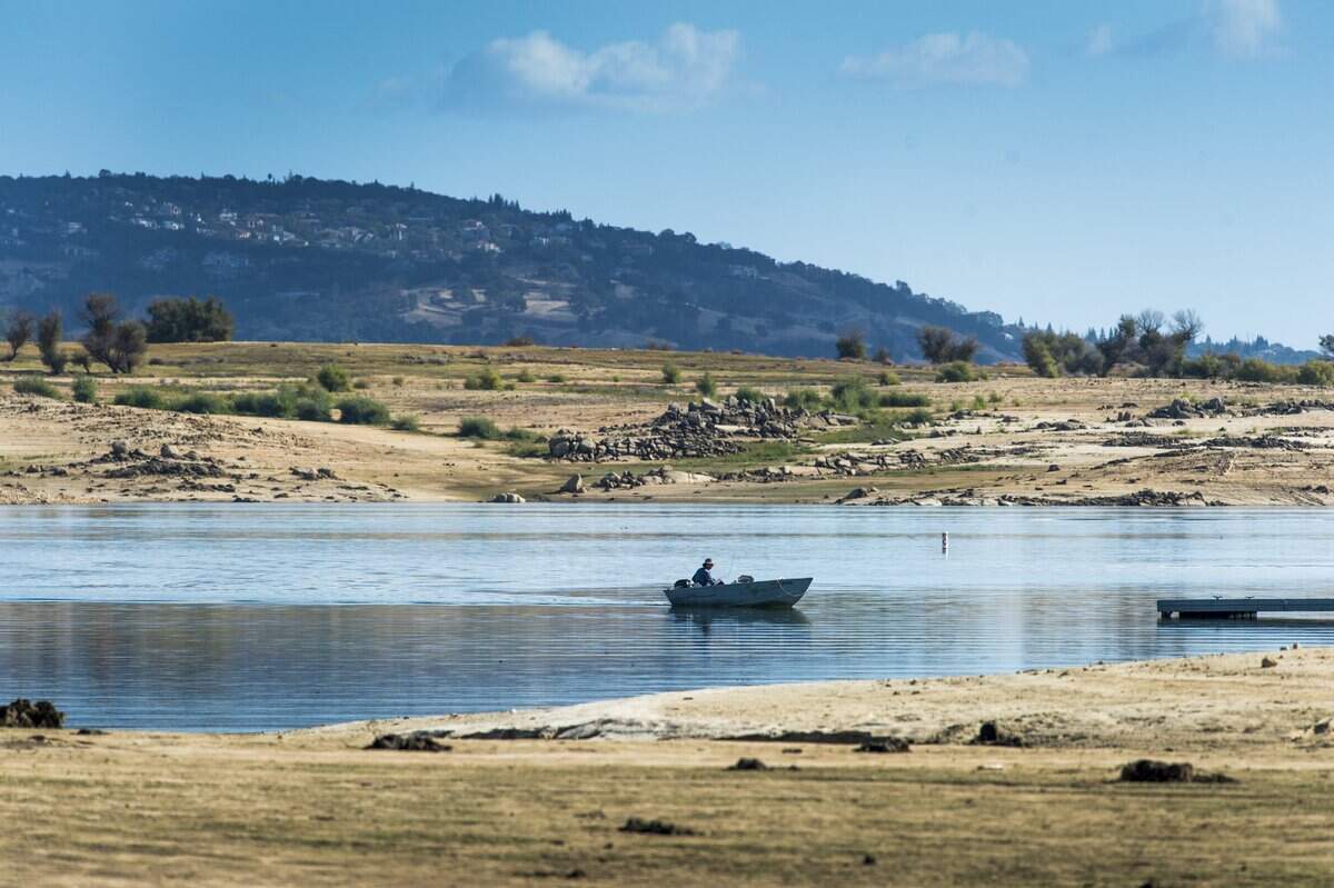
California learned that lesson the hard way this past water year: The state received near-average precipitation in many areas, but the April 1 snowpack was the second-lowest on record at just 18% of normal. In the Northern Sierra, it was an astonishing 6% of normal.
A strong El Niño could deliver even more precipitation this coming winter. However, if the storms are warm, the Sierra snowpack may fail to recover even in a wet year.
Floods: Work co-led by Swain with the U.S. Geological Survey and the California Department of Water Resources — known as the ARkStorm 2.0 megaflood scenario — found that of eight simulated weather sequences capable of producing the most extreme four-week precipitation totals in California, seven occurred during moderate to very strong El Niño events. The scenario ultimately chosen for the study used a sea surface temperature value remarkably close to what models are currently forecasting for this coming winter.
That same research found that climate change has already doubled the likelihood of a catastrophic California flood, and that runoff during extreme storm scenarios could be 200% to 400% greater than historical values in the Sierra Nevada — driven by both increased precipitation rates and the shift from snow to rain at elevation.
Swain also cautioned that El Niño does not guarantee any specific outcome like an ARkStorm or coastal landslide even while increasing the odds of such events.
“It pretty dramatically shifts the odds when it is strong,” he said. “It’s a shift both upward on the wet side and downward on the dry side.”
That may sound like hedging, but Swain is trying to communicate that even if the coming winter does not produce record-precipitation and abundant floods, it’s even more unlikely to be drier than any other winter. El Niños of this magnitude, in other words, are not adequately expressed as a maybe.
“I am personally and professionally quite frustrated with the conversation about El Niño and California rainfall among some California meteorologists right now,” Swain said. “It’s almost as if no one has read any literature on this from the last 25 years. It’s very strange to me … I think part of this comes from the fact that the last really big El Niño event in 2015, 2016 did not produce a wet winter really anywhere in California.”
The 2015-16 El Niño, the strongest on record and dubbed as a “Godzilla” El Niño at the time, did not produce expected drought-busting rains for the state. Swain said this and the tiny sample size of large El Niño events also makes it difficult to communicate the situation.
“I mean, we’re talking about a single-digit number of historical strong El Niño events, and in some cases, if we’re talking about very strong events, it’s a low single-digit number. Two of which were among the wettest years, if not the wettest years on record in most of California. One of which was not.”
Based on the current trajectory, the evidence “clearly points in the direction of greatly elevated odds of a wetter-than-average winter in California” that will “probably elevate the risk of both coastal and inland flooding” — coastal flooding from elevated sea levels that accompany El Niño combined with king tides, and inland flooding from heavier seasonal precipitation and individual large storms.
“It is rare to be able to say anything about the coming winter” this far in advance, Swain said. “This is a rare case where there is such a profound event unfolding in the tropical Pacific that we actually can say something about the shift in the odds for different kinds of potential hazards this winter, and the shift is away from drought and more toward flood.”
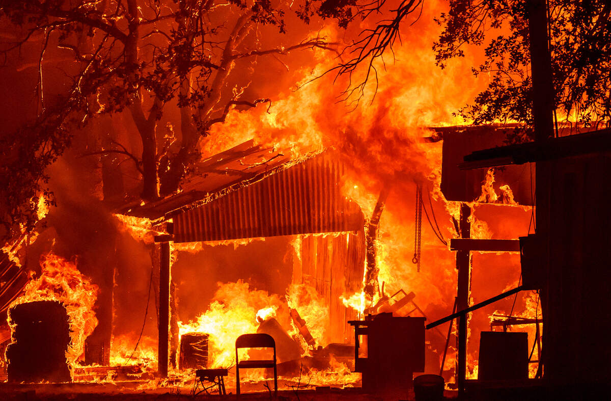
Increased fire risk next summer: A downstream consequence of a wet El Niño winter is what comes after. Heavy winter rains fuel explosive vegetation growth across California’s foothills, grasslands and forest understory. By next summer, as temperatures climb and the dry season takes hold, all that lush greenery will become fuel.
California saw exactly this cycle play out recently. A wet El Niño-boosted 2024 spring produced a burst of vegetation growth across the Northern California foothills. When heatwaves arrived in June and July, the growth dried out rapidly. The Park Fire ignited near Chico on July 24 and became the fourth-largest wildfire in state history, burning more than 429,000 acres across Butte and Tehama counties.
A super El Niño winter in 2026-27 could set the stage for a similar, or worse, fire season in the summer of 2027, especially if the climate pattern transitions to La Niña afterward, which tends to bring hotter, drier conditions back to California.
How will El Niño affect different parts of California?
The conventional wisdom is that the El Niño precipitation boost is most reliable in the southern half of the state, and that Northern California sits in a transition zone where the relationship between El Niño and winter rainfall is weaker and less predictable. Even the National Weather Service office in Sacramento states it plainly: “In Northern California, there is little correlation between precipitation and most ENSO patterns.”
Swain said that framing may be outdated — and that the magnitude of this particular event changes the equation considerably.
“For weak to moderate El Niño events, there truly is no real relationship with Northern California precipitation. It really is just not consistent,” Swain said. “But for strong and very strong events, El Niño’s relationship with California precipitation extends significantly farther to the north and does include the Bay Area, the Sacramento region, and most of the Sierra Nevada.”
That distinction matters because the historical record California meteorologists typically rely on contains only a handful of strong El Niño events — and even fewer very strong ones. Swain said analyses based on those small samples can be misleading, and that a growing body of peer-reviewed research using climate model simulations paints a starkly different picture.
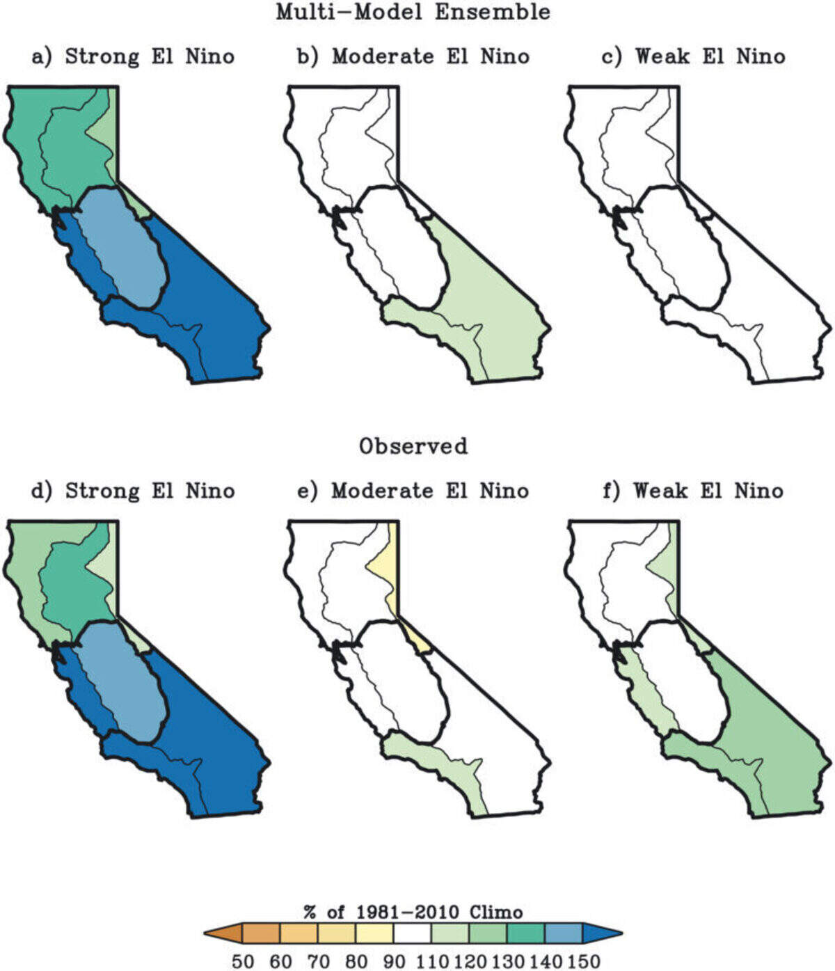
“We’re able to create much larger synthetic sample sizes that encompass dozens or even hundreds of strong and very strong simulated El Niño events, and when we do this, what we find is that there’s an incredibly powerful relationship between the strongest El Niño events and the wettest California winters,” Swain said.
It all adds up to a winter — and a year beyond it — unlike anything California has faced in the modern era. Not because any single storm is guaranteed to be catastrophic, but because the odds of something extraordinary happening have shifted further than they typically ever do.
El Niño is back. It might be bigger than ever before. And California, for better or worse, is about to find out what that means.
This story was originally published July 19, 2026 at 7:00 AM.