When and where to expect monsoon showers for the Central Valley as temps surge
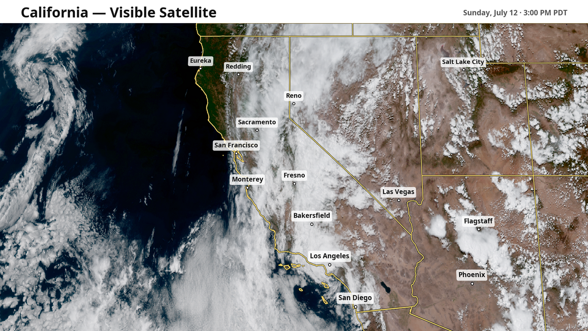
Sunday was an unusual summer day for much of Central and Southern California, bringing clouds and even sparse rain showers across much of the state as a monsoon was full steam ahead.
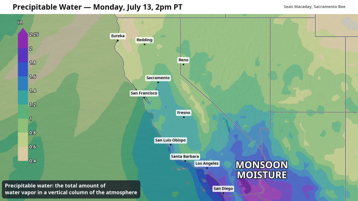
The North American monsoon – a weather pattern that invites tropical moisture into the region during the summer months – doesn’t always make its way all the way to Central and Northern California. The fact that is has is a sign of the strength of the weather pattern. That pattern is pointing towards some seriously hot temperatures later this week amid lingering chances for rain.
Sparse showers Monday and Tuesday, mostly for the Sierra
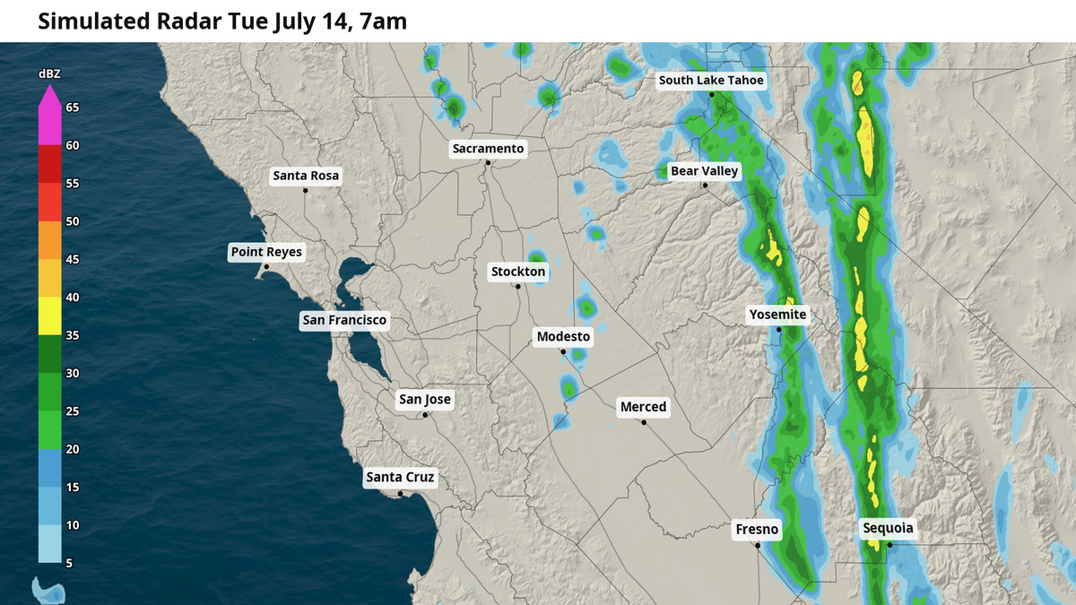
As the monsoonal moisture continues to arrive from the south, folks across Central California will find themselves under more occasional clouds as the moisture condenses higher in the atmosphere. These clouds will linger across the Central Valley through Monday and Tuesday morning before slowly lifting to the Sierra later Tuesday afternoon.
That moisture be seen in the clouds, and it will be felt too. Water, whether as a vapor or a liquid, holds heat quite well. Because of this extra humidity, low temperatures will be noticeably higher than usual over the next several days. For Sacramento and Modesto, low temperatures in the upper 60s are a stark departure from the mid- to upper 50s as of late, and folks in these areas will feel a need to use the air conditioning more overnight. Meanwhile, low temps in Fresno and the San Joaquin Valley up in the mid-70s.
A few folks might feel the moisture falling as rain. Rain is a rarity for the Central Valley during summer, but a strong monsoon can provide the exception to the rule. We saw this Sunday as a line of showers pushed across most of the San Joaquin Valley. Most of these raindrops did not reach the ground, but some broke through and more will to do so. While the occasional showers won’t be as strong or widespread as they were Sunday, a few more drops of rain are likely along the western foothills of the Sierra both Monday and Tuesday – especially overnight. Any rain that does fall would be light.
During this same stretch, brief thunderstorms and longer-lasting showers could put a damper on outdoor activities higher in the mountains. Rain totaling a tenth to quarter-inch is expected from Lake Tahoe south to Yosemite between Monday and Tuesday, with brief but intense afternoon thunderstorms posing a dry lightning risk. Be mindful of rapidly shifting weather conditions in the Sierra through Tuesday.
Triple digit temps widespread Tuesday and Wednesday
The same weather pattern bringing this monsoonal moisture is also responsible for the heat set to arrive soon. To our east, a large “heat dome” has taken shape across the Rocky Mountains – high pressure air higher in the atmosphere that is dictating the weather pattern across the entire western U.S.
This heat dome is pushing down and heating the air directly beneath it. On Sunday, Salt Lake City recorded a new all-time high temperature record of 108 degrees, while parts of eastern Montana hit an astonishing 115 degrees.
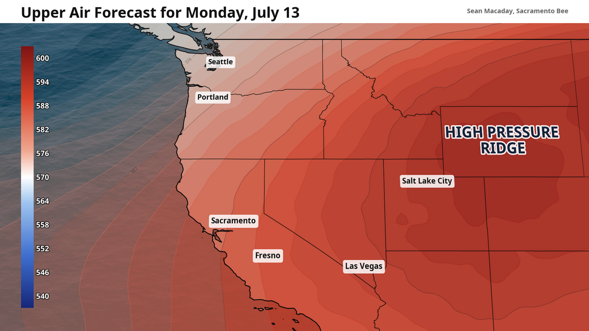
The atmosphere has to work extra hard to distribute all this extra heat appropriately. With a southeasterly breeze across California, the North American monsoon has been pushed into Central California. As the atmosphere continues to distribute this heat, the hot temperatures will spread over a greater area.
While Monday high temps for the Central Valley will generally be in the 90s, that heat truly arrives on Tuesday, when high temps in the triple digits will extend from Redding to Bakersfield. Wednesday is a repeat of these temperatures, but without passing clouds to provide some shaded relief.
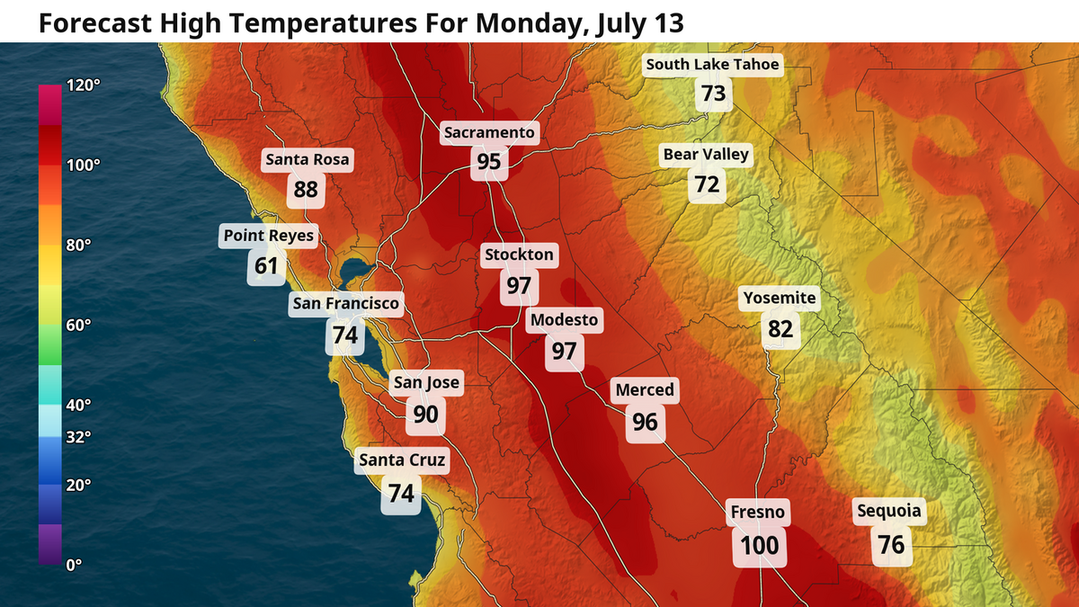
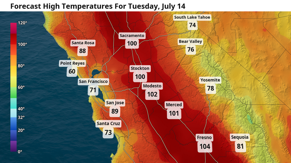
Temperatures slowly moderate into the weekend back towards average, with high temperatures in the low 90s for the Sacramento and Modesto, thanks to the return of the Delta breeze, and upper 90s for Fresno and the rest of the San Joaquin Valley.
But the monsoon is far from over. With a strengthening El Niño at play, more moisture will be available to crash into California from the south over the summer months. There are hints that more monsoonal moisture could return later this weekend or next week as the atmosphere attempts to adjust to El Niño’s influence.