The real heat returns this week to the Central Valley — here’s when
After a glorious July 4 weekend with typical temperatures and sunny skies, we are set to roll into our first full week of July with much of the same splendid outdoors weather. Enjoy it now — it won’t be here for much longer.
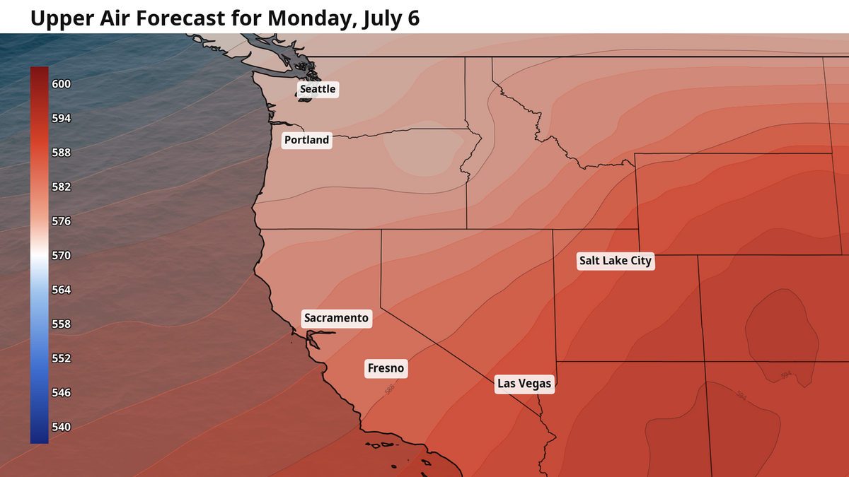
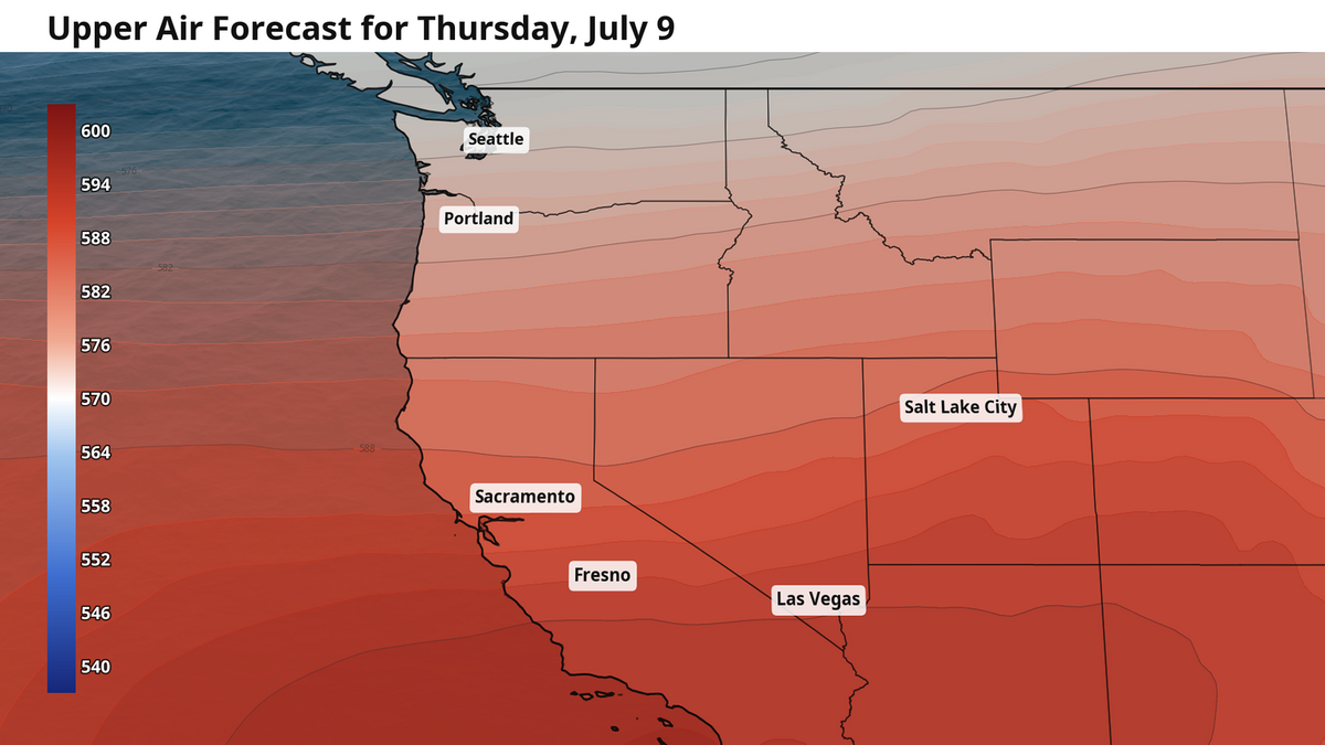
Later this week, the pattern that has been keeping our temperatures mostly at or below average the past few weeks will change. We covered this last week — lower pressure in the upper atmosphere is associated with cooler temperatures. Even the “heat dome” in the eastern U.S. – itself a buildup of higher pressure in the upper atmosphere – plays a part in keeping the upper air pressure low and our temps cool.
As the heat dome erodes over the course of this week, the upper atmosphere begins to level out. That means higher upper atmospheric pressure for the western U.S. You will feel it this week as temperatures slowly rise between Monday and the weekend.
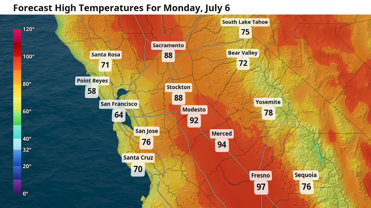
High temperatures Monday for Sacramento will peak in the upper 80s with sunny skies. Traveling south, temperatures quickly climb thanks in part to both higher pressure and less of the Delta breeze to cool things down. Modesto reaches into the low 90s, and Fresno and the southern San Joaquin Valley reach all the way into the upper 90s.
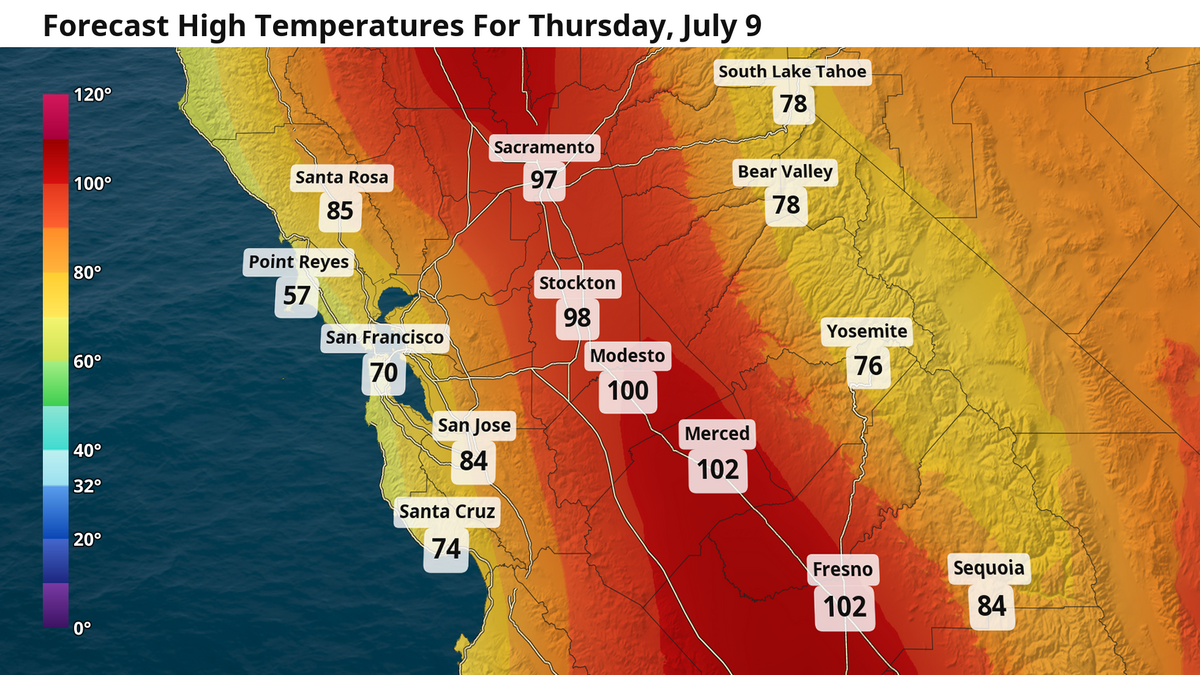
It only takes a few days for the return of the heat to really settle in. By Thursday, high temperatures in Sacramento stretch into the mid- to upper 90s, with triple digits for Modesto, Merced, Fresno and the rest of the San Joaquin Valley. This heat will likely persist all the way through the weekend, although some welcome passing clouds could shave off a few degrees Saturday and Sunday.
Even more heat on the horizon
Early signs point to the potential for our own West Coast “heat dome” developing in mid-July. The extent of our exact temperatures, wind pattern, marine layer, and fire risk will all be downstream of where the highest pressure conditions of the heat dome set up. If it is directly to our east, we may be watching for an increase in wildfire risk. If it sets up directly overhead, then we could be dealing with temperatures well above 100 degrees.
It is too early to say for certain how high it will climb, but what we do know is that it will get much hotter for an extended stretch through July. Enjoy the next few days of 80- and 90-degree high temperatures while they are still here.
Your forecast for the week
Sacramento: Low temperatures in the early morning of Monday in the mid- to upper 50s. High temperatures reach into the upper 80s with sunshine and a nice evening Delta breeze. Tuesday is a repeat, but with a few extra morning clouds. Temperatures a touch warmer Wednesday with highs in the low 90s, and reaching the upper 90s on Thursday. Highs in the mid- to upper 90s hold on through the entire weekend, with some passing clouds here and there making the outdoors a bit more enjoyable.
Modesto and Merced: Monday morning begins with temps in the mid- to upper 50s from the night before. Highs in the low 90s with sunshine. Tuesday and Wednesday are a repeat. Highs rise into the upper 90s and low 100s Thursday and persist through the weekend. Meanwhile, some extra passing clouds allow heat to build up in the San Joaquin Valley during the overnight hours. Low temperatures rise into the upper 60s this weekend.
Fresno: Monday begins with low temps in the upper 60s across most of the southern San Joaquin Valley. Sunshine is strong all day, with highs quickly reaching the upper 90s. Tuesday and Wednesday repeat. Highs surge into the triple digits Thursday and linger through the weekend and into next week, with even hotter temperatures possible in a little over a weeks time. Passing clouds over the weekend could keep overnight lows in the mid-70s by Sunday.