Sacramento’s heat is back. How unusual was summer’s start — and what’s next?

If it feels like Sacramento caught a break from the heat this summer, you’re not imagining it. The thermometer hasn’t touched 100 degrees since June 13 — and Tuesday and Wednesday’s expected triple-digit highs could snap a roughly monthlong stretch without one. It could be just the third 100-degree day this summer measured at Sacramento Executive Airport, capping a start to summer that has been, by Sacramento standards, remarkably gentle.
Normally by this point in summer, we have measured seven or eight triple-digit days, according to the climatological average over the past 30 years. Over just the past 10 years, nearly every year had a faster start to triple digit summer days. Just two years ago in 2024, Sacramento had already felt two full weeks of days 100 degrees or hotter.
Oddly enough, the only year in the past decade that wasn’t off to a hotter start than us now was last year. By this point, 2025 had only two 100-degree days. And by the end of meteorological summer, 2025 had logged 11 triple-digit days, showing that most of the heat was still to come. That is the case most years, as Sacramento summers typically see 19 100-degree days by the time the sun sets on Aug. 31.
Why so cool these past two years? It comes down to the weather pattern. The jet stream – the ultimate arbiter of day-to-day weather – dictates where warmer air and cooler air are allowed to settle across North America. If the jet stream lifts north far enough, it can allow a stream of warmer air from the tropics to pool together as self-reinforcing high pressure.
These stubbornly stable “heat domes” are a common phrase in summer for those experiencing heat waves. This year, like last year, had a record strength heat dome set up across the eastern United States. That means that most of the serious above-average heat was kept to the east, away from California, to kick off summer.
Tuesday and Wednesday – triple digits return as rain dies down
After a few days of a few unseasonable rain drops for Central California – including some more persistent showers and thunderstorms in the Sierra – the weather has begun to tame slightly. A few pop-up showers are possible on the foothills and further up in the Sierra later this afternoon and overnight. Otherwise, the main feature of the day will be those 100-degree temps returning to most of the Central Valley, even despite some more occasional clouds passing through.
.png "sac_high_tue_0714 (1).png")
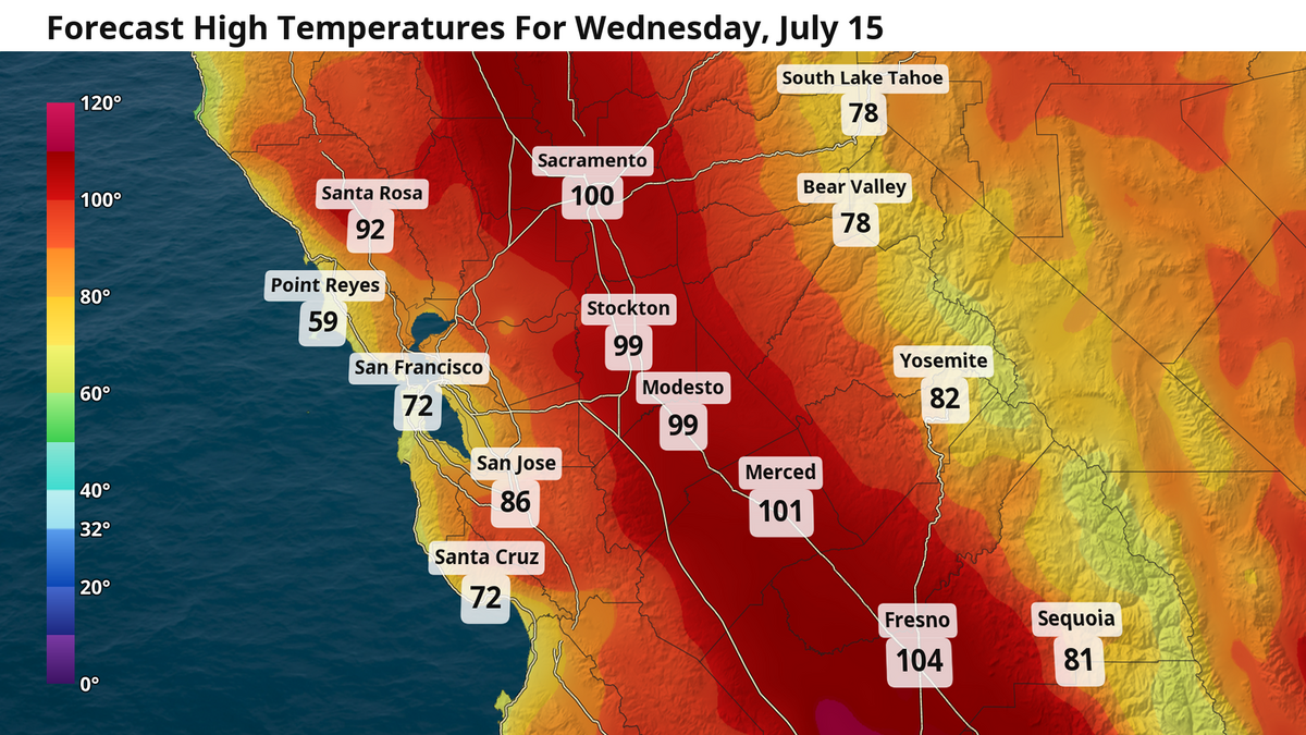
By Wednesday, it’s back to our typical summer programming of sunny skies amid these triple-digit high temperatures. The heat dome across the central U.S. will be close enough to our east to snuff out the Delta breeze Wednesday, allowing nearly the entire valley to reach these hot temperatures. Fortunately for Sacramento and Modesto, that is not quite the case later this week and weekend as the Delta breeze returns and drops high temps into the 90s. Further south, the rest of the San Joaquin Valley will face triple digit temps all through the weekend.
The San Joaquin Valley swelters
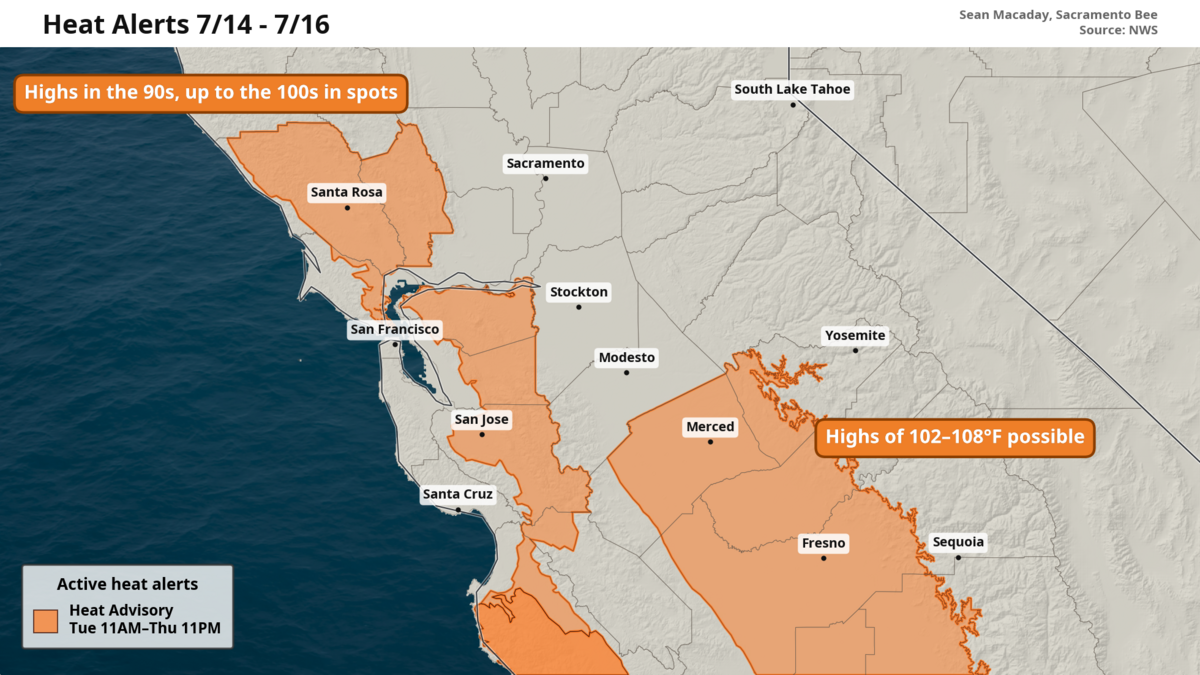
Temperatures could rise to nearly 110 degrees in portions of the San Joaquin Valley over the next three afternoons. A swath of heat advisories is out from Merced, down through Fresno, and south to Bakersfield amid these hazardous temperatures. During this time, low temperatures will only drop into the mid- to upper 70s with this extra monsoonal humidity. Temperatures here will dip a touch into the weekend, but only into the low 100s.