How hot will Sacramento and the California State Fair get this weekend?
After triple-digit temps made themselves felt earlier this week – with a high of 104 degrees on Wednesday – Sacramento is thankfully cooling off a touch just in time for the State Fair.
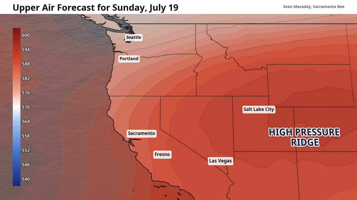
Earlier this week, high pressure air further up in the atmosphere was dominating the skies and pushing temperatures in the Sacramento Valley well above 100 degrees. It was only the third and forth triple-digit-degree days this summer for Sacramento. Thankfully, that high pressure in the upper atmosphere has weakened some, and is now moving eastward.
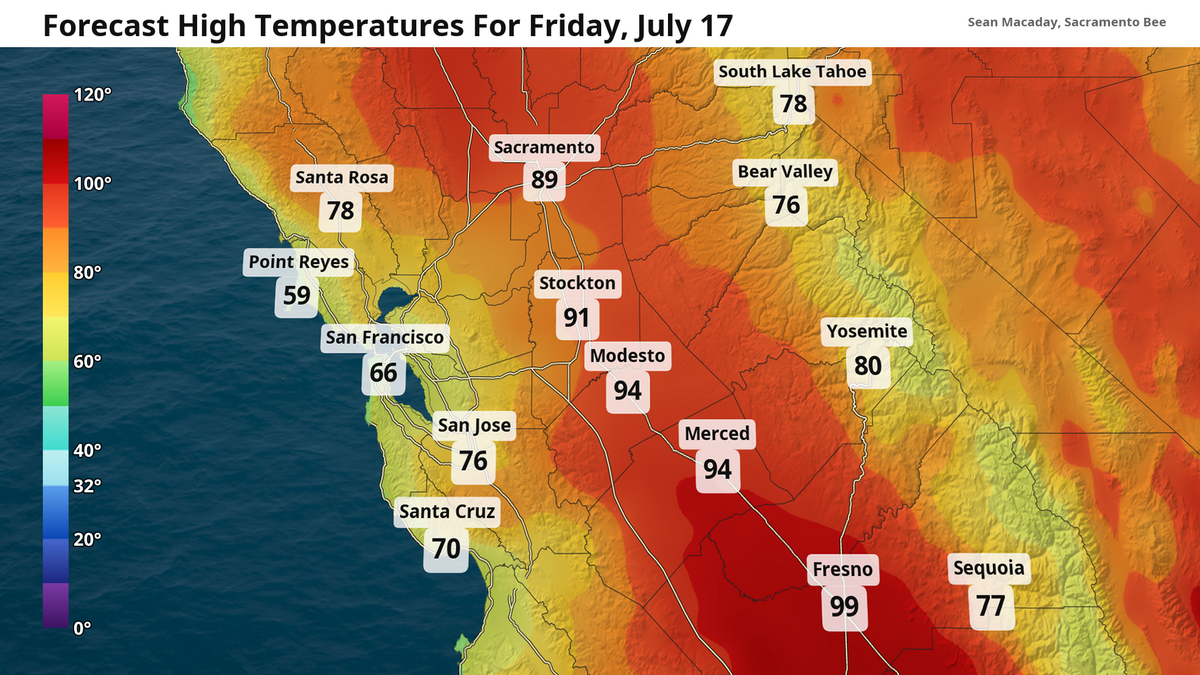
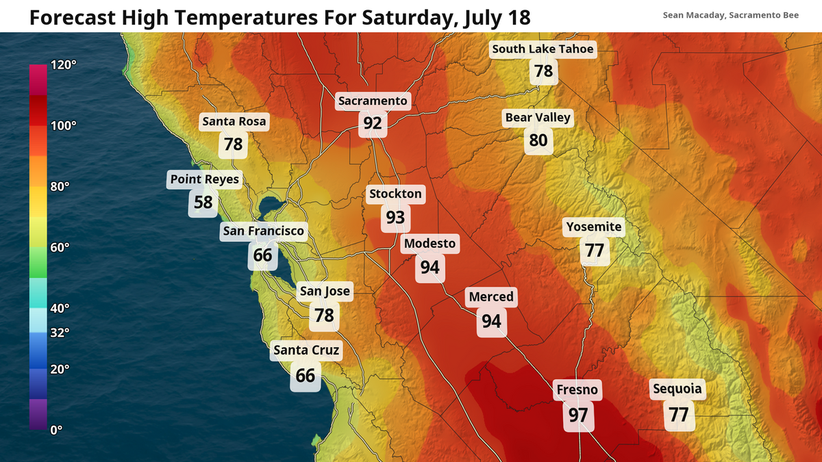
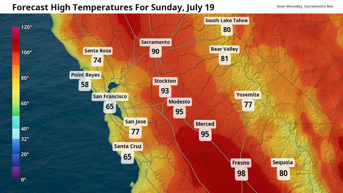
This translates to temperatures moderating back to average for this time of year, with highs in the low to mid-90s. Even our low temperatures will make a huge recovery. Morning temperatures in the 50s mean that you can open the windows overnight.
State Fair – cooler than the past few years
Last year, high temperatures for the opening weekend of the California weekend were not as kind for folks looking to hang out in the sun and eat funnel cakes. Opening day in 2025 hit a high temperature of 102 degrees, with the next few days hovering around there.
The year before that significantly worse. Opening day 2024 featured a high of 111 degrees, with triple-digit highs lingering for another 10 days straight following. Brutal.
This year, by comparison, looks like a dream come true for fairgoers. High temps in the low to mid-90s will be much more forgiving for whatever your plans are. A nice Delta breeze Saturday afternoon at 20 mph and some passing clouds Sunday will be nice touch for those looking to take advantage.
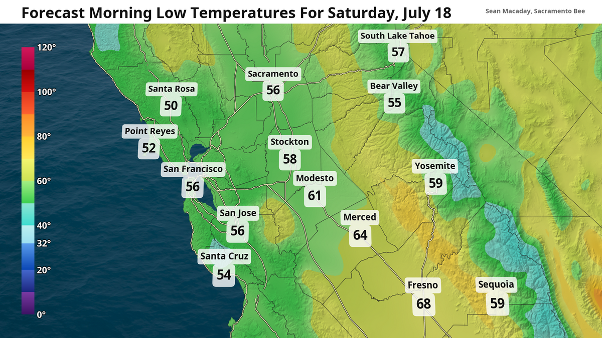
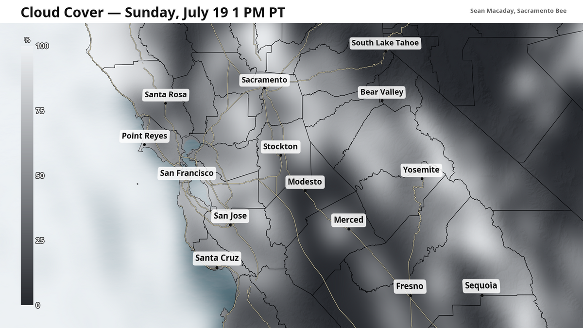
It is important to be mindful of the heat when out in the sun for hours at a time. Be sure to stay hydrated when enjoying these more formidable temperatures.
Looking ahead — nice and easy, more monsoonal moisture possible
The weekend really is looking quite nice for the entirety of the Central Valley and California at large. Weakening high pressure to our east is slowly reducing scorching hot temperatures from earlier this week and diminishing the monsoonal moisture that provided unseasonable rain showers and thunderstorms.
Both of these features may make a return later next week. There are early signs that a “ridge” of high pressure to the east may strengthen for late July. If it does this and stays in its current position — or even moves a bit back west — it would invite more monsoonal moisture from the tropics across California alongside warmer temperatures.
There is also a decent reason to believe this might not materialize – intense smoke from ongoing wildfires in Ontario and Minnesota are covering the skies across the Midwest and Northeast. Smoke is so dense in spots that it is meaningfully lowering temperatures and altering the careful dance of air pressure across the continent. If this continues, it could keep the hottest temperatures next week away from California.