Storms are aimed at Northern California this week and next, forecasts show. What to know
READ MORE
Northern California Storms
Click on the arrow below to read more on the storms and flooding in Northern California.
Expand All
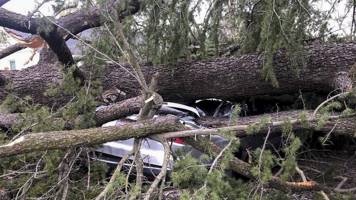
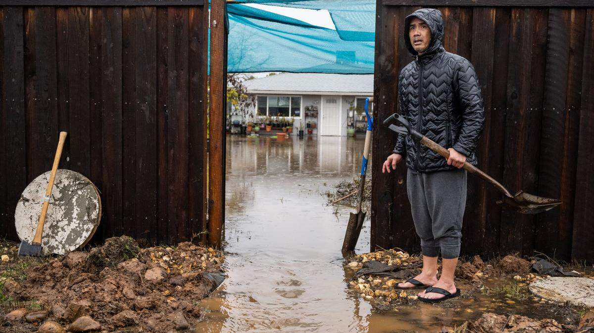
On its face, the severe storm arriving in Northern California by Wednesday figures to bring relatively similar rain totals and wind speeds to the Sacramento region as the mighty New Year’s Eve storm that cut power for hundreds of thousands and flooded rural portions of the county, prompting mandatory evacuations and widespread road closures.
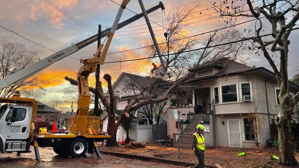
But the impact of the inbound storm could be even worse than that of this past weekend’s devastating torrent, for a simple reason: The region hasn’t had a chance to dry off.
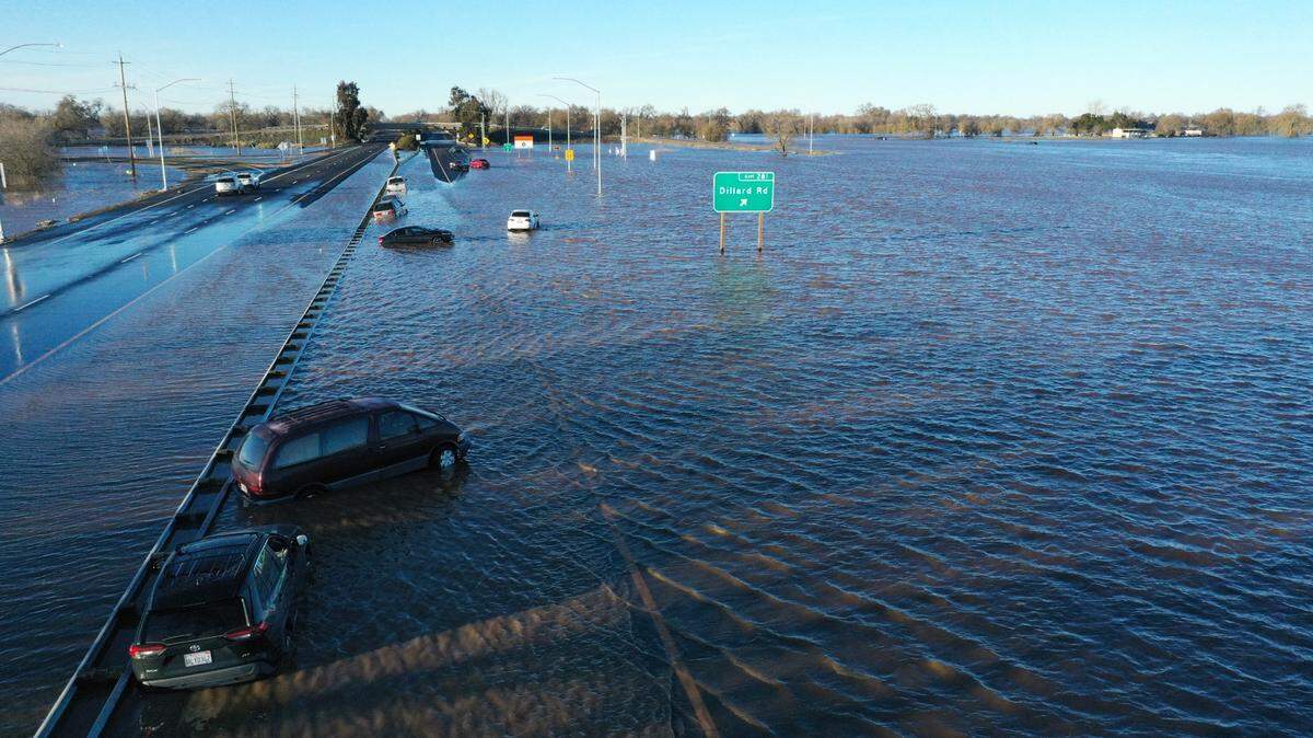
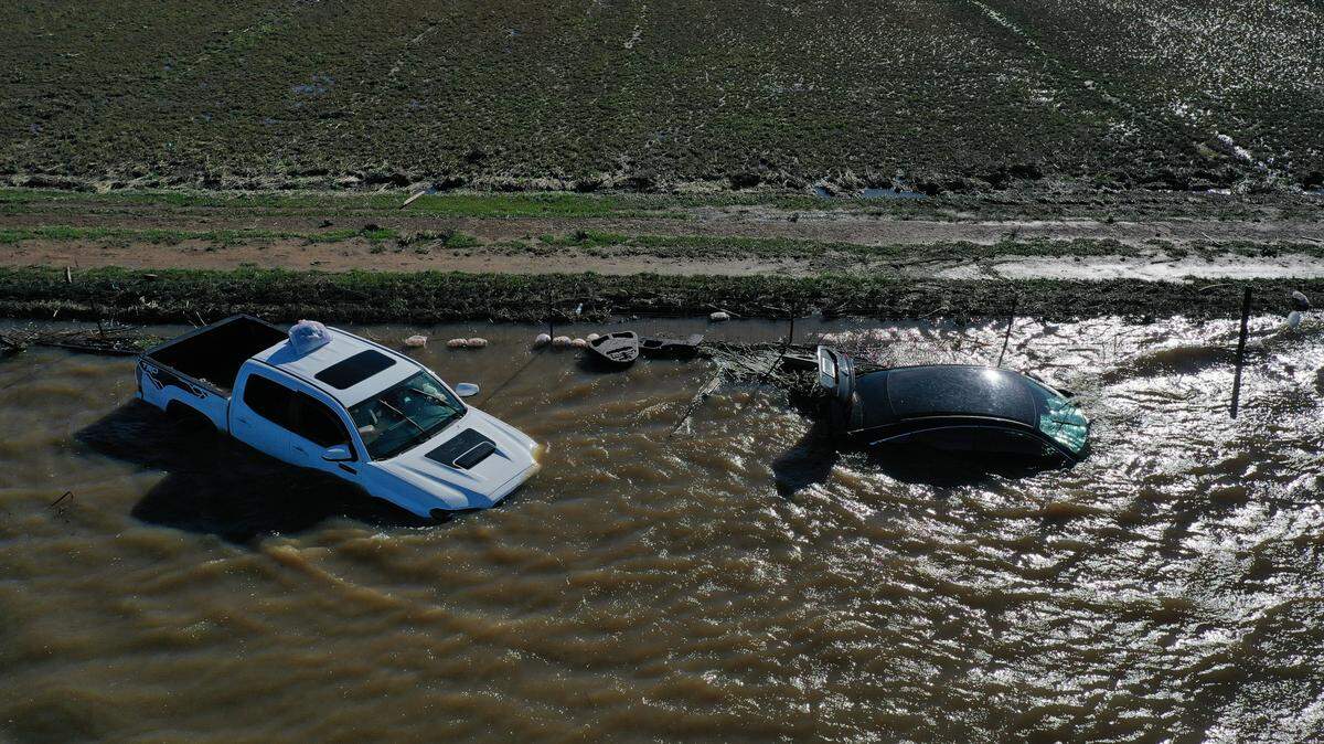
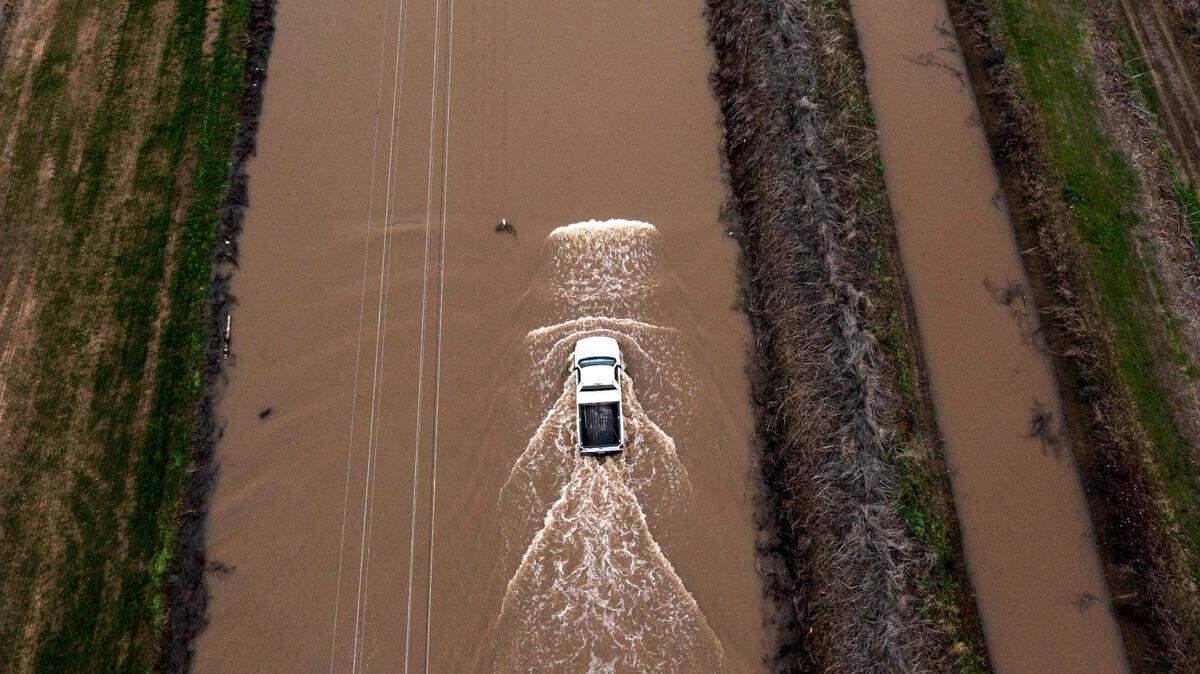
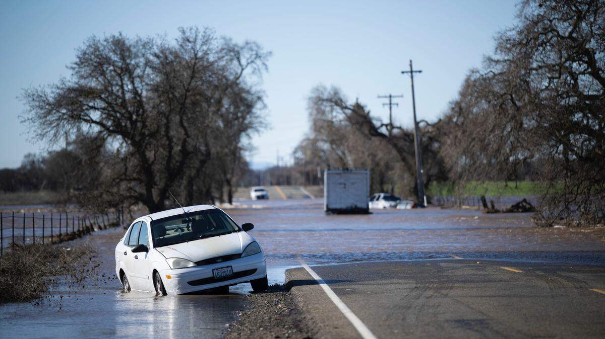
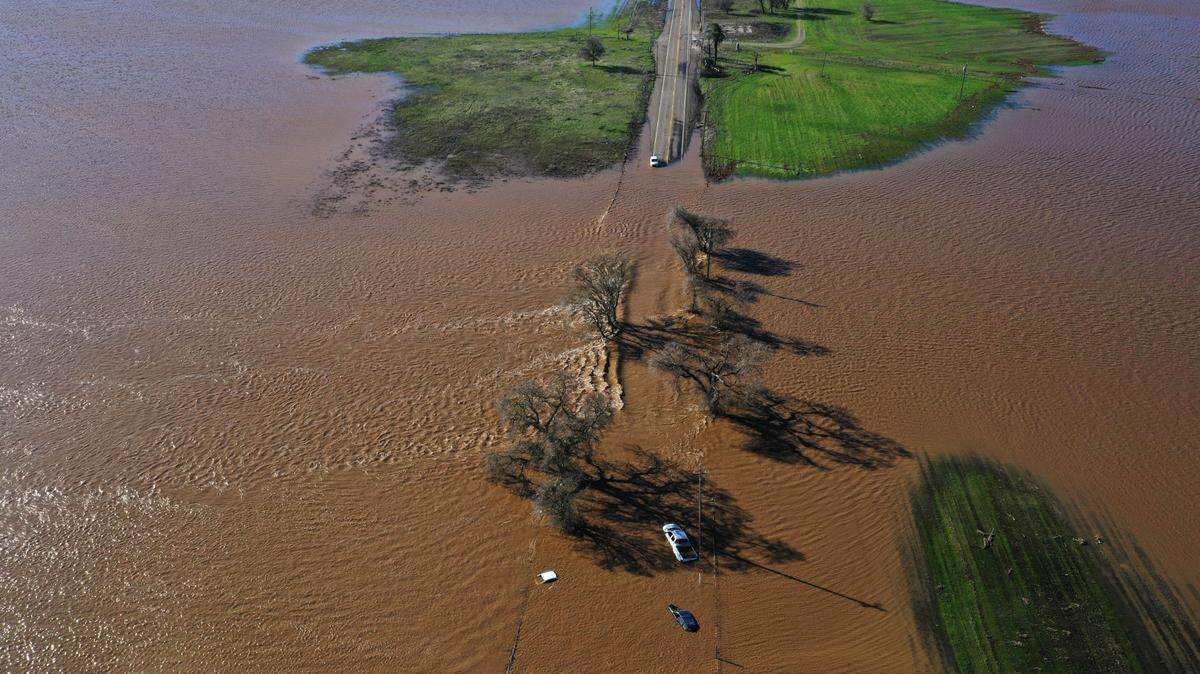
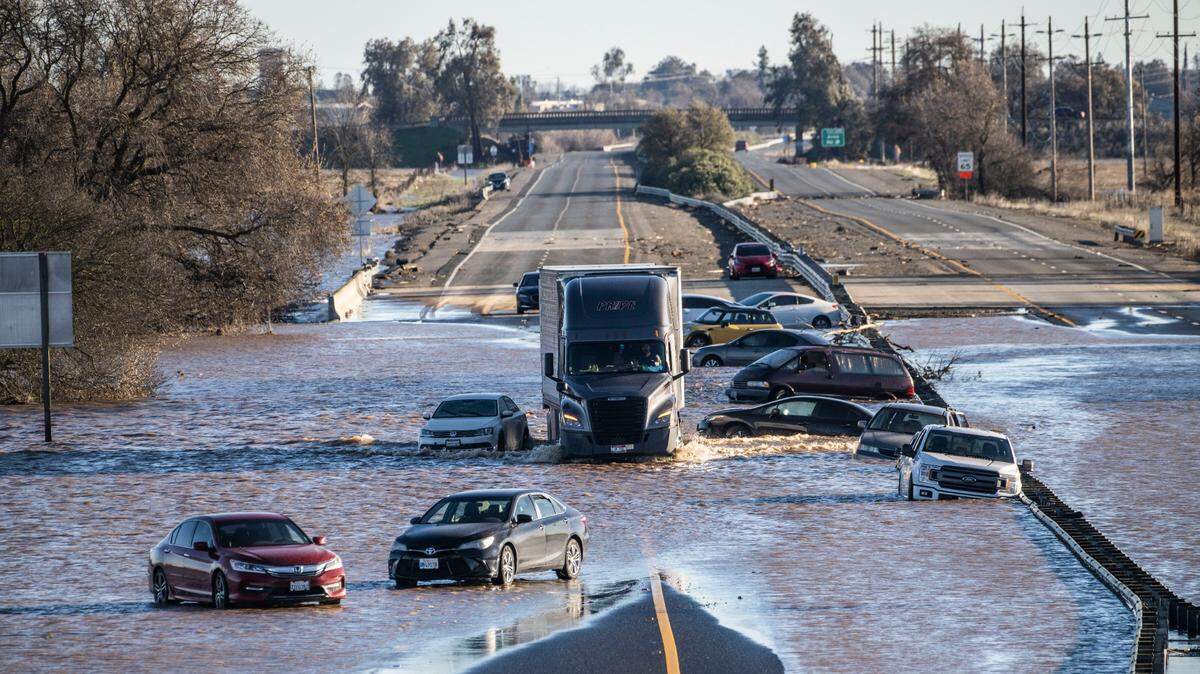
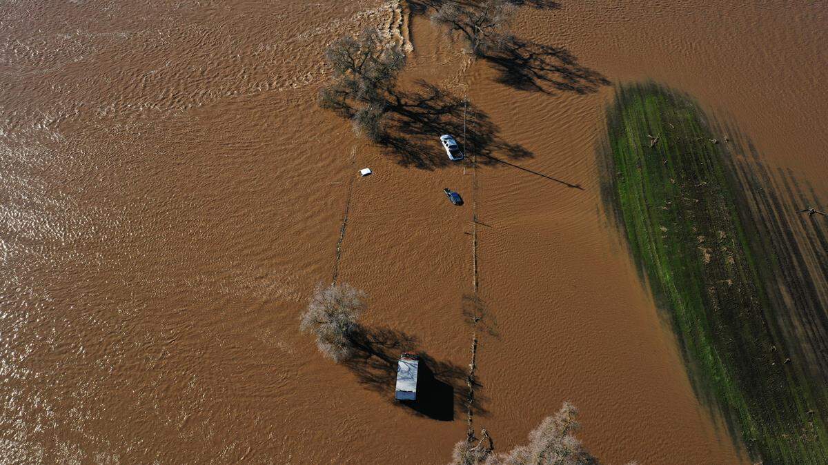
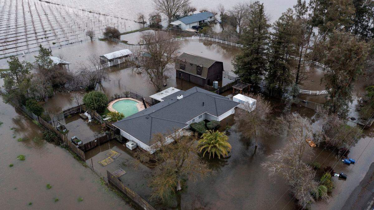
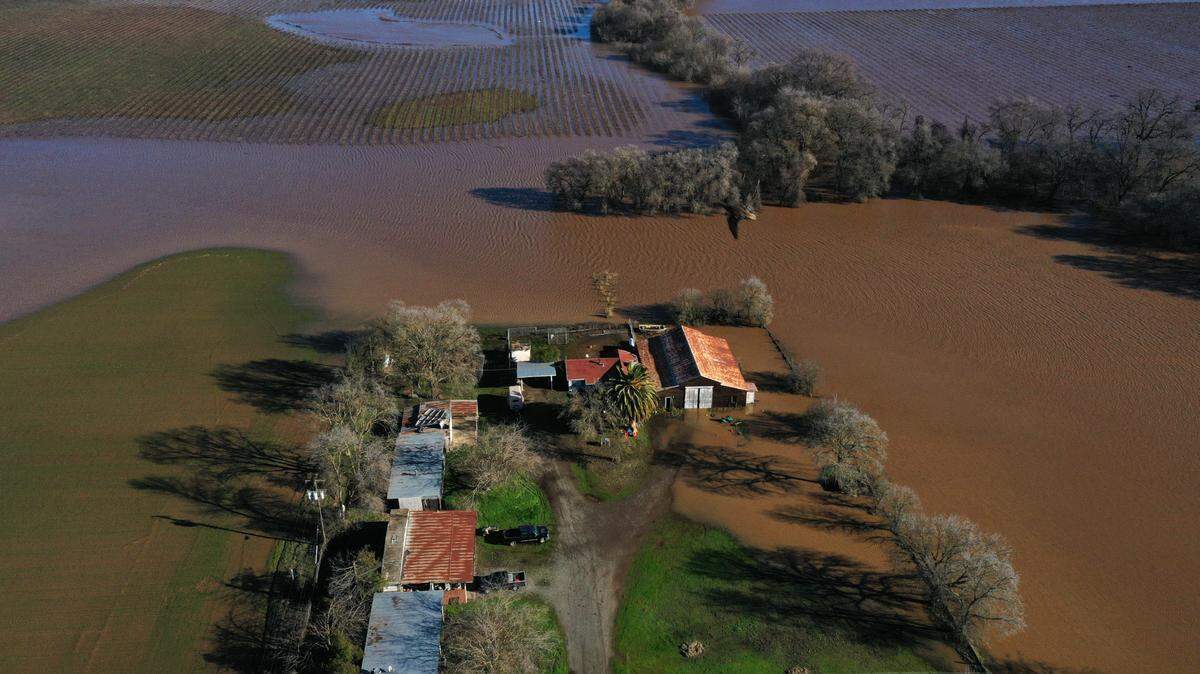
The short window between the two severe storms, both the result of “atmospheric river” systems rolling in from the Pacific, means the ground remains sodden. Much of the rain expected to fall Wednesday won’t be able to soak into the soil, instead running off and creating what could be dire levels of flood risk for waterways that are already running exceptionally high from New Year’s Eve downpours.
“Area rivers, creeks, and streams are running high, particularly along the Cosumnes and Mokelumne rivers, and are expected to rise with more heavy rain,” the National Weather Service wrote in a flood watch bulletin Tuesday morning.
According to the weather service, which has the flood watch in place from Wednesday morning through Friday morning for most of interior Northern California, this means “extensive” street flooding is likely to develop, especially in low-lying areas and those with poor drainage.
Weather and emergency officials are urgently reminding drivers not to attempt to traverse flooded roadways.
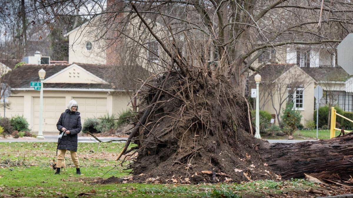
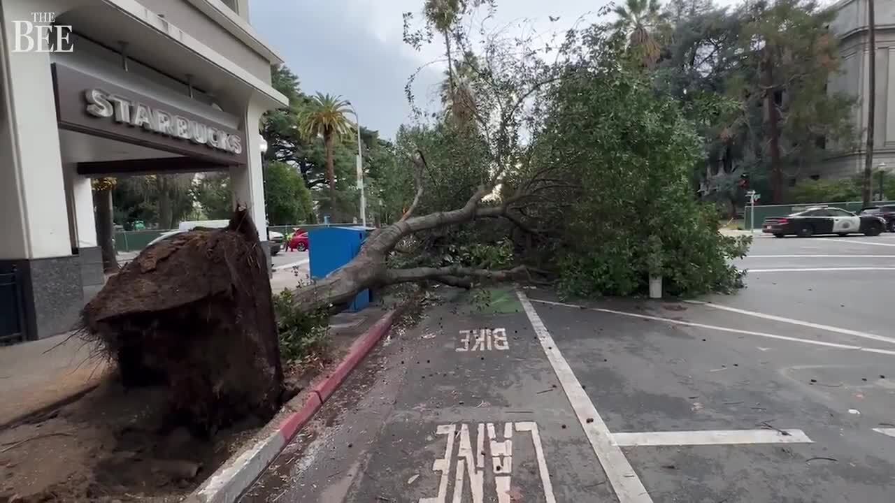
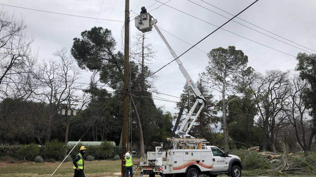
The weather service in a forecast update Tuesday morning said Wednesday’s winds, gusting up to 60 mph near Sacramento, will have an “extreme” impact on the region.
Gusts of similar intensity howled on New Year’s Eve and were largely responsible for cutting electricity to nearly 200,000 homes and businesses losing power across the four-county capital region.
This week’s storm comes from a bomb cyclone. What is that?
The atmospheric river system hitting California by midweek is linked to a “bomb cyclone” system — a phenomenon also known as bombogenesis, in which a rapid drop in pressure produces a strong storm system.
Another bomb cyclone, in 2019, brought heavy rain to the valley and snow to the Sierra Nevada mountains, and parts of the foothills, during the week of Thanksgiving.
A bomb cyclone was also responsible for the arctic blast system that ravaged the eastern two-thirds of the U.S. starting just before Christmas. The direct impact of that cold snap missed California.
What’s coming to California after this week’s storm?
As of Tuesday, Northern California’s weather conditions beyond this Thursday remained uncertain.
At least moderate precipitation is expected to continue Friday and last through at least next Monday, according to the weather service.
Early forecasts from climate prediction centers show as many as three more atmospheric river systems could hit California in the week following Wednesday’s storm.
Daniel Swain, a UCLA climate scientist, said ensemble forecasts from Scripps Institution of Oceanography, which showed that atmospheric river systems could peak this coming Sunday, on Jan. 10 and on Jan. 13.
Swain wrote on Twitter that there is “substantial uncertainty” surrounding the magnitude of those storms.
The ensemble forecasts showed a range of possibilities: the system anticipated for Jan. 10 was expected to range between a moderate and weak atmospheric river storm, while the ones possible this coming weekend and on Jan. 13 could range anywhere from moderate to too weak to be considered an atmospheric river at all.
“Right now, the range of outcomes is from widespread minor to moderate flooding to widespread severe flooding,” Swain wrote in response to a question regarding flood concerns. “Likeliest outcome is somewhere in between those two extremes, but that’ll come down to exact storm sequencing which is hard to parse more than a few days in advance.”
This story was originally published January 3, 2023 at 10:25 AM.