Live updates: Winter storm slams Northern California, two bodies found in flood waters
READ MORE
Northern California Storms
Click on the arrow below to read more on the storms and flooding in Northern California.
Expand All
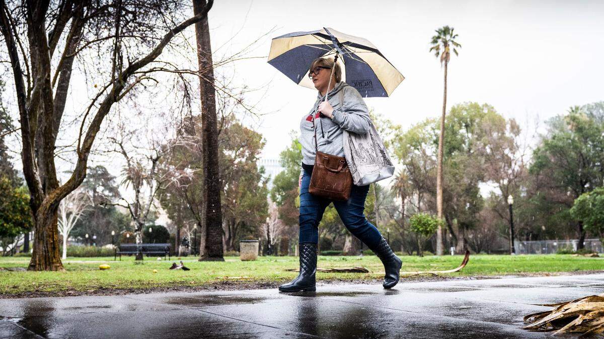
Barely four days after getting struck by a powerful atmospheric river, a major winter storm carrying heavy rain, strong wind and Sierra snow is striking Northern California and the Sacramento region.
The storm was expected to hit the region early Wednesday and last into Thursday. Forecasts show up to 3 inches of rain could fall in the Sacramento region and wind gusts exceeding 50 mph could topple trees and power poles. Even more rain is expected in the foothills and parts of the Bay Area.
Here’s the latest as the storm develops.
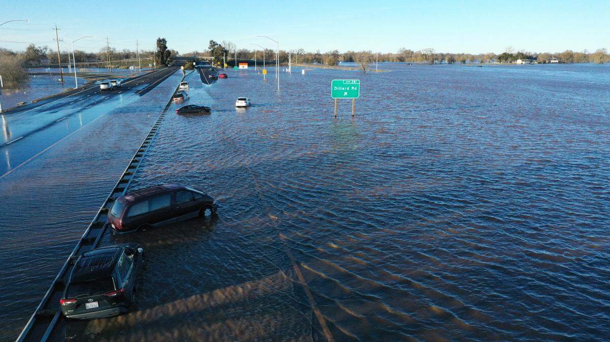
Second, third body found from weekend flooding in Sacramento County
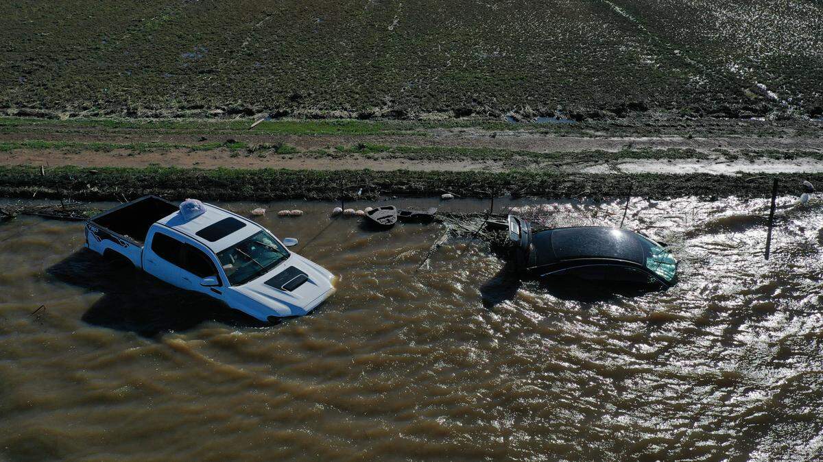
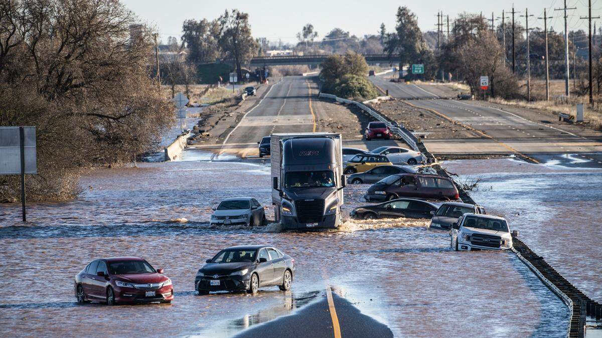
Authorities found two more bodies Wednesday while recovering vehicles in the floodwaters south of Elk Grove.
The California Highway Patrol found the body of a woman while recovering vehicles during the morning in an area near Dillard Road, which runs south of Elk Grove and Wilton, according to Officer Mark Leavitt, a spokesman for the California Highway Patrol’s South Sacramento office.
CHP officers discovered the woman’s body around 10 a.m., Leavitt said. She was outside of a vehicle. On Wednesday night, the Coroner’s Office identified the woman as 57-year-old Mei Keng Lam of San Leandro.
Late Wednesday, the Sacramento County Sheriff’s Office confirmed the discovery of another body. The identity of the victim was not disclosed, but officials say the body was found inside a vehicle near New Hope and Orr roads in Galt.
It is at least the second and third deaths authorities have connected to flooding in Sacramento County. Officials with the Cosumnes Community Service District Fire Department said previously that crews located a body inside a vehicle found Sunday morning, also along Dillard Road, near Highway 99.
Winds pick up as second storm approaches
“Widespread precipitation is still on the way! Afternoon radar shows precipitation approaching interior NorCal, with the potential for flooding of roadways, urban areas, creeks, & streams,” the National Weather Service tweeted around 3 p.m.
“Strong, damaging winds will also develop after dark with widespread gusts 45-60 mph in the Valley. Stay clear of trees and downed power lines, maintain a safe distance from high-profile vehicles, & be prepared for power outages!” the agency wrote a few minutes later.
As predicted, the wind started to gust after 3 p.m. throughout the region; the National Weather Service recorded a wind gust of 46 miles per hour at the Sacramento Executive Airport at 3:13 p.m.
The number of Sacramento Municipal Utility District customers without power went up, from 450 a few hours earlier to more than 620 by 3:30 p.m. and 5,253 an hour later, according to the utility’s website.
Palm fronds littered the Broadway Triangle as well, dumped from high above. Streetlights flickered, then died at 14th Avenue and Martin Luther King Blvd. at around 4:20 p.m., one of the first power outages of the afternoon.
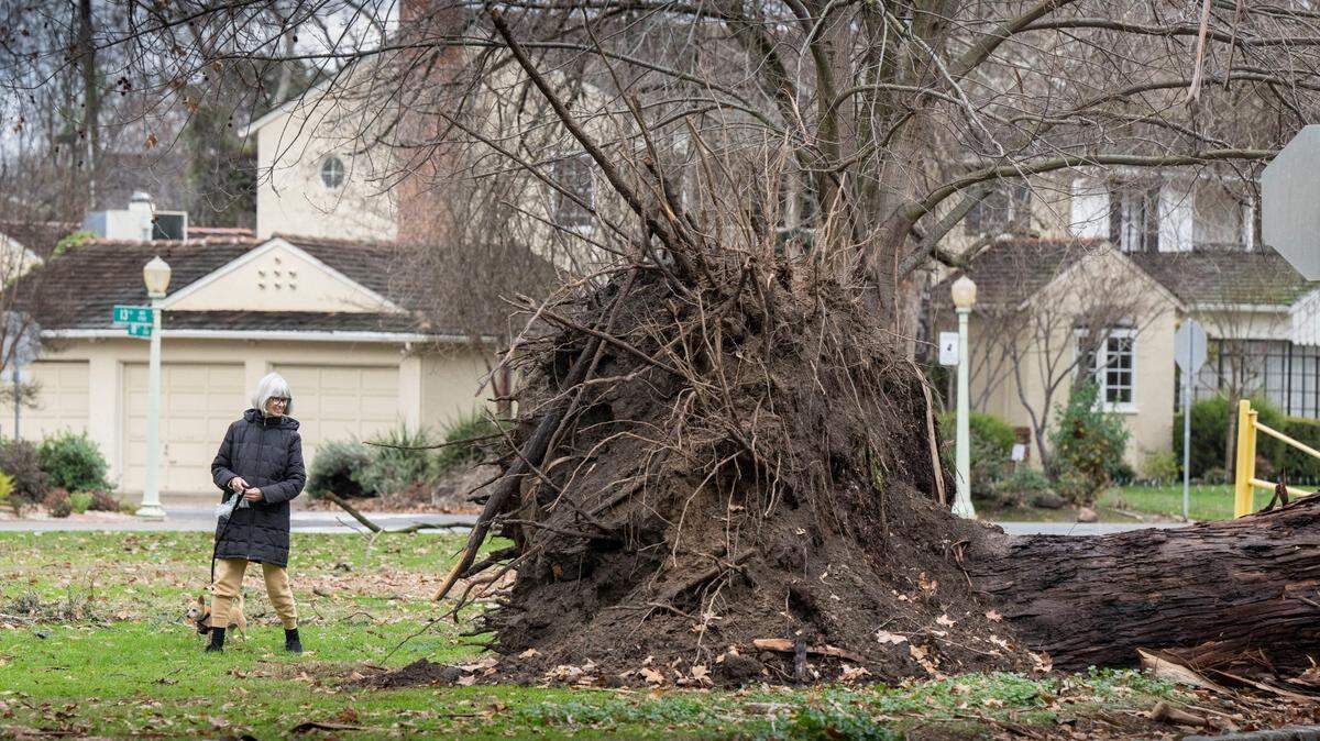
Trees bent and business signs swayed along Bradshaw Road in Rancho Cordova. An electronic sign on Interstate 5 near Riego Road warned drivers of the incoming “severe weather,” and urged them to postpone travel until Thursday night. Broken tree branches floated down the high-water Sacramento River a mere mile away, held back from Garden Highway by a levee.
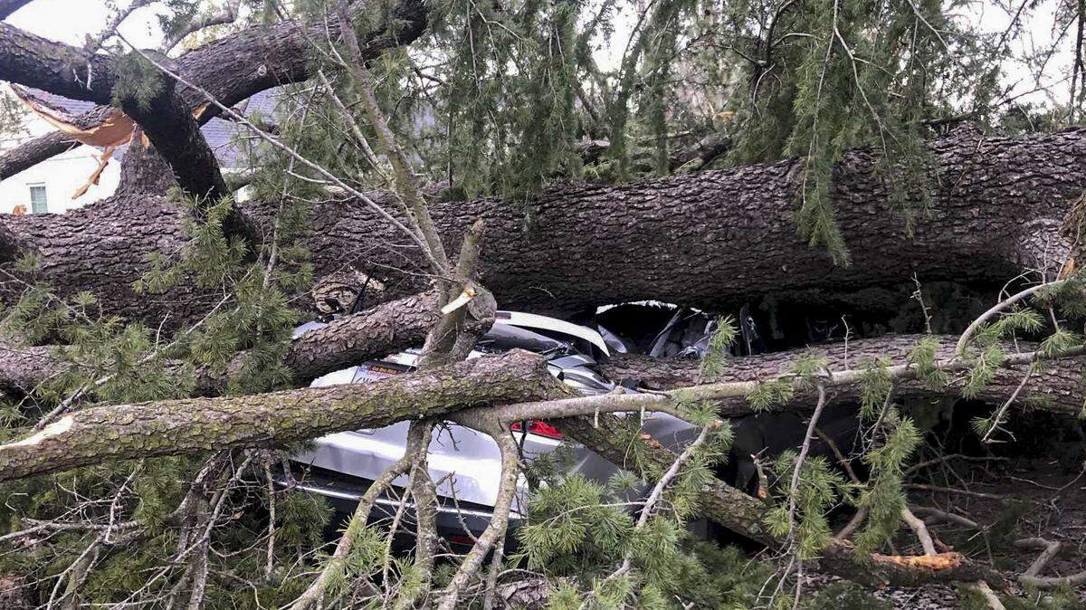
A large tree in Curtis Park’s southeast corner lay in pieces on the grass, chopped up to avoid catastrophe. Crews hadn’t gotten to another tree a half-mile away at 12th Avenue and 34 Street: it had toppled through a residential fence and onto someone’s car, shattering the front and rear windshields and closing off the street.
Broadway play canceled
A production of Broadway’s “Frozen” at the SAFE Credit Union Performing Arts Center in downtown Sacramento was canceled Wednesday night as strong winds intensified across the region.
Meanwhile, a Sacramento Kings home game scheduled for 7 p.m. at Golden 1 Center was still on as scheduled. Mayor Darrell Steinberg said residents should avoid heading out as wind gusts eclipsed 45 miles per hour in some parts of the city.
“I know this may not be popular with my friends with the Kings and Broadway Sacramento – and I support them wholeheartedly – but I would urge people if at all possible to stay home,” the mayor said, moments before it was announced the Broadway production had been called off. “I just want people first and foremost to be safe. My message is safety first. Really the message is: put your safety and the safety of those around you first.”
“Currently, all other performances will run as scheduled,” the group wrote in an email to patrons. “In an effort to accommodate patrons who purchased into tonight’s sold-out show, Disney Theatrical Productions has added a performance of FROZEN on Wednesday, January 11th at 1:30 PM.”
Patrons who bought a ticket to Wednesday’s play “can click here to choose a refund or exchange” for the Jan. 11 show.
Gov. Gavin Newsom declares emergency
California Gov. Gavin Newsom has issued a statewide emergency declaration in response to the storms and flood danger, Nancy Ward, director of the Governor’s Office of Emergency Services, announced during a news conference Wednesday morning.
“We anticipate that this may be one of the most challenging and impactful series of storms to touch down in California in the last five years,” said Ward, whom Newsom appointed director of Cal OES on New Year’s Eve. “If the storm materializes as we anticipate, we could see widespread flooding, mudslides and power outages in many communities.”
Karla Nemeth, director of the state Department of Water Resources, said extremely gusty winds are expected to be the primary force behind Wednesday and Thursday’s storm damage.
“This is an extreme weather event, and we’re moving from extreme drought to extreme flooding,” Nemeth said.
“What that means is a lot of our trees are stressed after three years of intensive drought, the ground is saturated and there is a significant chance of downed trees that will create significant problems — potentially flooding problems, potentially power problems.”
Wade Crowfoot, California’s natural resources secretary, said state and local officials were working simultaneously Wednesday to prepare for the coming storms while responding to damage and impacts from the major New Year’s Eve storm.
Officials urge against nonessential travel
State transportation leaders during Wednesday’s Cal OES news conference urged Californians not to traverse the roadways Wednesday or Thursday unless absolutely necessary.
“Stay home; avoid those nonessential trips, at least until the peak of this storm subsides,” Caltrans Director Tony Tavares said.
Caltrans and the California Highway Patrol “will be proactively closing roadways if we feel the conditions are unsafe,” Tavares said.
Impact on the homeless
The city of Sacramento opened two weather “respite centers” for the homeless at its Outreach and Engagement Center (3615 Auburn Blvd.) and the North Fifth Street Shelter lobby through Saturday morning. Sacramento County expanded its capacity at the North A Shelter and is opening the Howe Park Community Center.
Sacramento Regional Transit is providing transportation to the city shelters from City Hall. The last shuttle leaves City Hall at 6 p.m.(the pick-up spot is on 10th Street between I and H streets).
Mayor Darrell Steinberg said the city was preparing to offer shelter to the homeless throughout the storm.
“We’re prepared to do this for several days,” the mayor said. “My colleagues are working their networks, we’re all working our networks to get the word out. We want to make sure there’s a safe place for everyone who wants to come in.”
The city’s Department of Community Response was contacting residents of homeless camps about the centers. Steinberg said he was hopeful that word would spread about the available shelters, especially as Sacramento faces several days of inclement weather ahead.
“We want to make sure we’ve set up an infrastructure and a process that can be reactivated fast,” he said.
Earlier Wednesday, the city of Sacramento towed at least five vehicles that were being used by homeless people as emergency shelter. The vehicles had been parked on the side of Auburn Boulevard.
“They picked the worst day to do this,” said Joe Hill, whose trailer had been towed.
The city towed vehicles after receiving multiple complaints from businesses and residents, Kelli Trapani, a city spokeswoman, said in a statement. Among the complaints were vehicles parked in the same place longer than 72 hours, which is against the state vehicle code, vehicles blocking the sidewalk, and waste being discarded into the streets and gutter, she said. The city towed five vehicles after tagging 94 in the area on Dec. 28, she said.
“During this inclement weather, the decision to remove any vehicles in violation of California Vehicle Code will be made on a case-by-case basis, taking into account both public safety and the safety of those occupying vehicles,” Trapani said.
Latest rain totals, forecast
The early Wednesday storm that moved through dumped a moderate amount of rain on the region.
Preliminary totals varied, from about .44 inches in Woodland to .22 inches in downtown Sacramento, said Idamis Del Valle-Shoemaker, a meteorologist with the National Weather Service. Sacramento International Airport and Davis had both received a bit more than .3 inches as of 1 p.m.
The rain was expected to resume after 7 p.m. in the Sacramento region, with wind gusts getting stronger throughout the afternoon. The wind was already gusting to 23 miles per hour at Mather Airport just before 1 p.m.
Rain and wind were expected to last into Thursday, Del Valle-Shoemaker said. By the time the rain stops, between 2 and 2.5 inches of rain was expected to fall on Sacramento County.
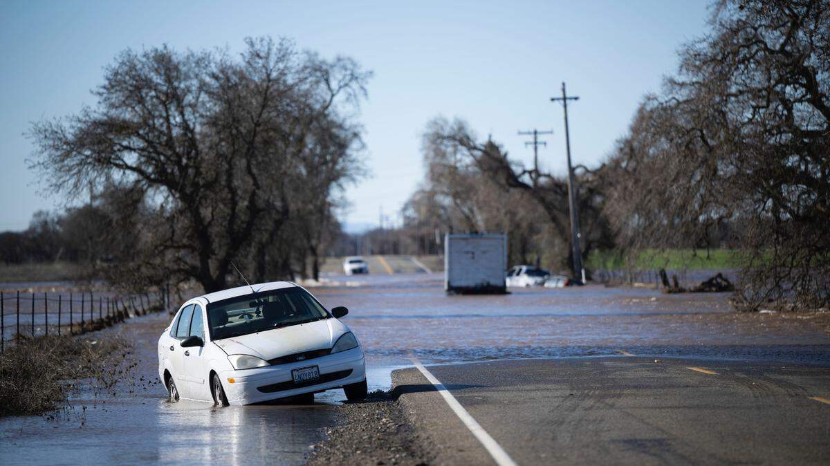
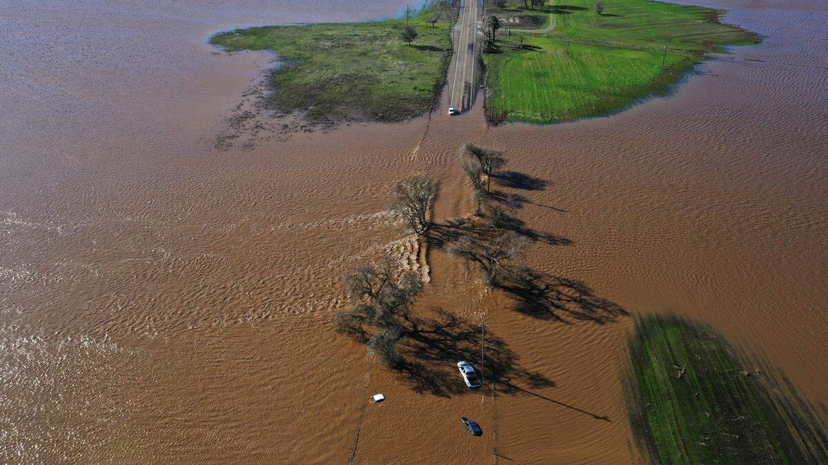
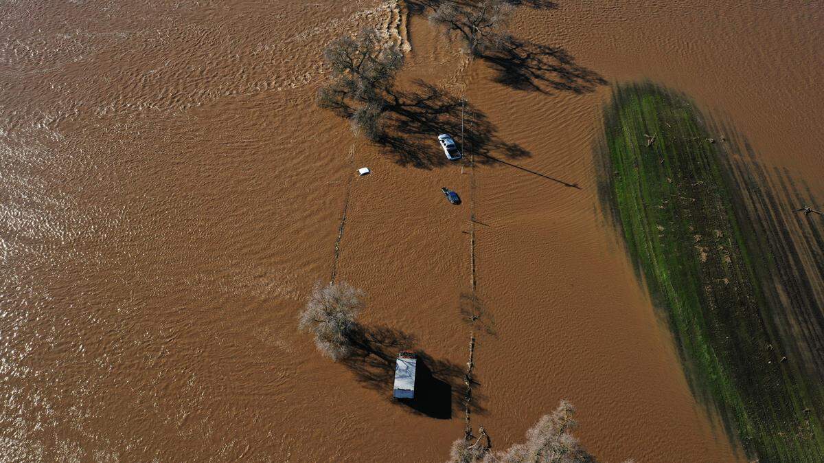
Where in California might rivers reach flood status?
The California Nevada River Forecast Center, in a daily briefing Wednesday, reported four river points in California that are forecast to exceed flood stage and another 19 that are forecast to surpass flood monitor stage within the next five days.
The four points included two along the Russian River, one on the Navarro and one on the Eel River. The Eel River is forecast to flood at Fernbridge – the same bridge damaged last month by a magnitude 6.4 earthquake that shook Humboldt County.
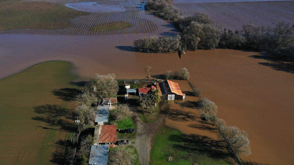
The 19 river points forecast to reach at least flood monitoring stage include 10 along the Sacramento River, including near Rio Vista; two points on the Cosumnes River and one on the Mokelumne River. The latter two rivers overflowed during in the New Year’s Eve storm, prompting evacuations in rural parts of south Sacramento County.

Cal OES deploys resources, including to Sacramento
The Governor’s Office of Emergency Services in a statement Wednesday afternoon said it has “strategically prepositioned critical resources” in 12 counties: Contra Costa, Lake, Los Angeles, Monterey, Orange, Sonoma and El Dorado, where weather officials have issued warnings for wildfire burn scar areas; as well as Sacramento, Butte, Santa Barbara, Stanislaus and Marin, where there are “major” flooding concerns.
State officials announced resources for Los Angeles, Orange, Santa Barbara and Stanislaus counties Wednesday afternoon, following deployment that morning to the other eight counties.
Cal OES is deploying 14 incident management team units, two helicopters, five fire engines and a swift water rescue team to Sacramento County, according to the news release.
“Residual flooding impacts could linger into the weekend before another potentially impactful storm returns early next week,” state emergency officials wrote.
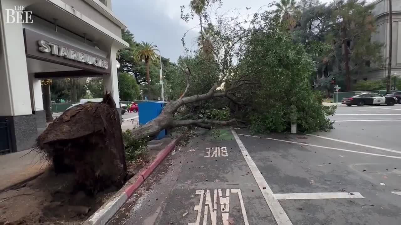
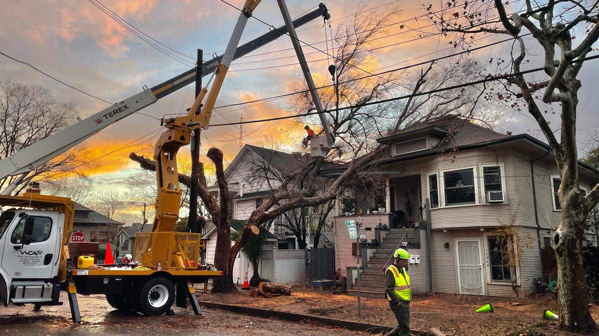
Downed trees block roadways
Hundreds of trees fell during the New Year’s Eve storm, and more were expected to fall as the winds pick up late Wednesday and into Thursday.
In midtown Sacramento, 28th Street between K and L streets was closed off Wednesday as crews cleared fallen trees and clogged storm drains. That block is just outside the Sutter Medical Center and Sutter’s Fort.
Toppled trees from the weekend storm blocked roadways and knocked out power throughout the region, in some places for three days.
‘Two waves’ in Wednesday storm, forecast shows
There will likely be a brief break in Wednesday’s precipitation, the National Weather Service’s Sacramento office said in a morning update, separating a wave of more moderate rainfall in the morning from the anticipated evening downpour.
Radar forecasts show rainfall should pause in the Sacramento Valley by about 2 p.m. or 3 p.m. Then, a more intense round will begin around 6 p.m. and continue through early Thursday morning.
Gusts of nearly 25 mph were recorded shortly before 9 a.m. at Sacramento Executive Airport. The strongest wind gusts are expected Wednesday afternoon through early Thursday morning, the weather service said, forecasting gusts up to 55 mph in the capital city Wednesday evening.
How to prepare for the storm
People who rely on electricity for medical devices, people in flood-risk areas as well as unsheltered homeless people are at the greatest risk of harm, and emergency officials urged Sacramento residents to seek shelter or stay at home — off the roads, and away from trees.
Residents can sign up for emergency alerts at sacramento-alert.org and should, if possible, stock up on water, put gas in their cars, preemptively charge necessary electronic devices and check their flashlights’ battery life. Placer County has set up a webpage for emergency alerts at placer.ca.gov/ReadyPlacerDash.
The Sacramento County Board of Supervisors ratified an emergency proclamation over the winter storms in a special meeting Tuesday, paving the way for Sacramento County to get additional funds from the state, as well as aid from the Federal Emergency Management Agency. The county’s Office of Emergency Services has been activated since Dec. 28, in anticipation of the first damaging storm that started Dec. 31.
At the short meeting Tuesday, Supervisor Sue Frost suggested people move their cars away from trees.
“We are anticipating a fairly strong storm,” Mary Jo Flynn-Nevins, chief of emergency services in the county, said at the Tuesday board meeting. “Its highest impact is going to be heavy rain and very, very strong winds, not necessarily in that confined two-hour period that we experienced Saturday evening. ... I’m concerned about sustained gusts of wind throughout the day that could topple trees.”
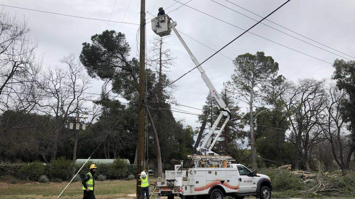
SMUD reports scattered outages from New Year’s Eve storm
Some 450 homes and businesses across Sacramento County remained without power Wednesday morning, Sacramento Municipal Utility District’s online outage map showed as of 1 p.m.
Many of those have been stuck in an outage since the weekend, when more than 165,000 SMUD customers lost power during the New Year’s Eve storm.
SMUD more than doubled its field crew total, from 16 to 33 teams working toward power restoration, the company said in a social media post Tuesday.
“Restoration efforts can be slowed when winds are too high for crews to safely work or access is limited or not possible due to floods,” SMUD tweeted. “Both of those conditions are likely on Wednesday.”
The utility provider also reminded residents not to attempt to remove fallen tree limbs or other debris from downed power lines.
“Tree limbs and other objects can conduct electricity that can shock anyone coming in contact with them.”
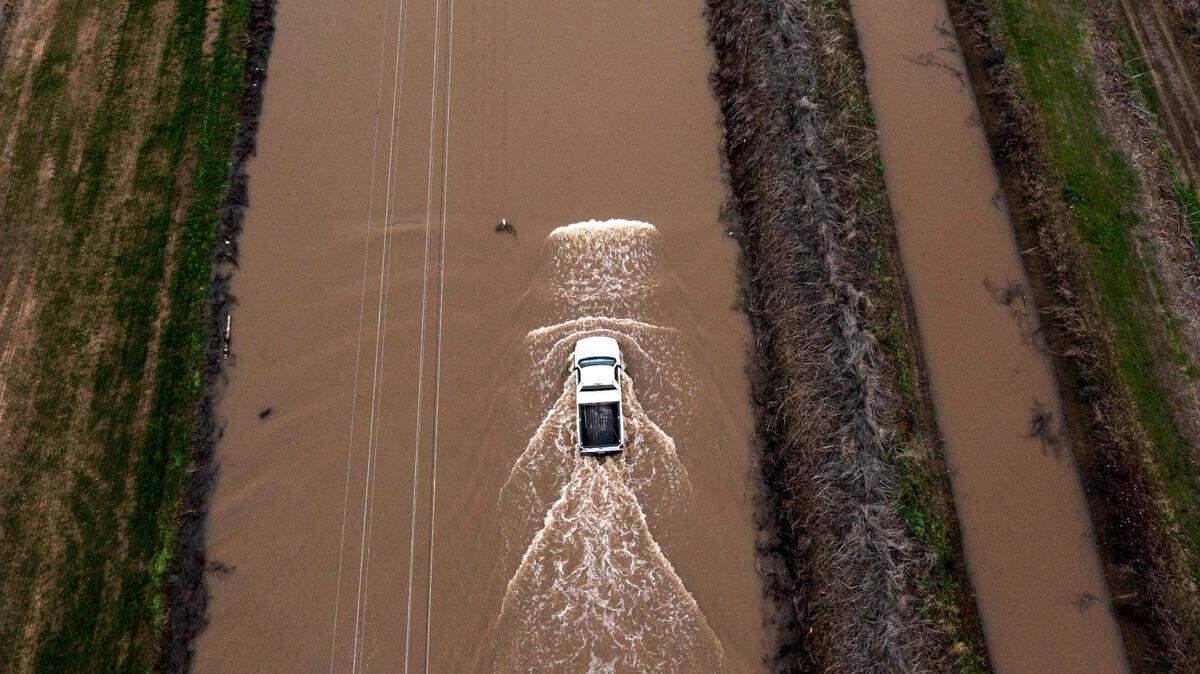
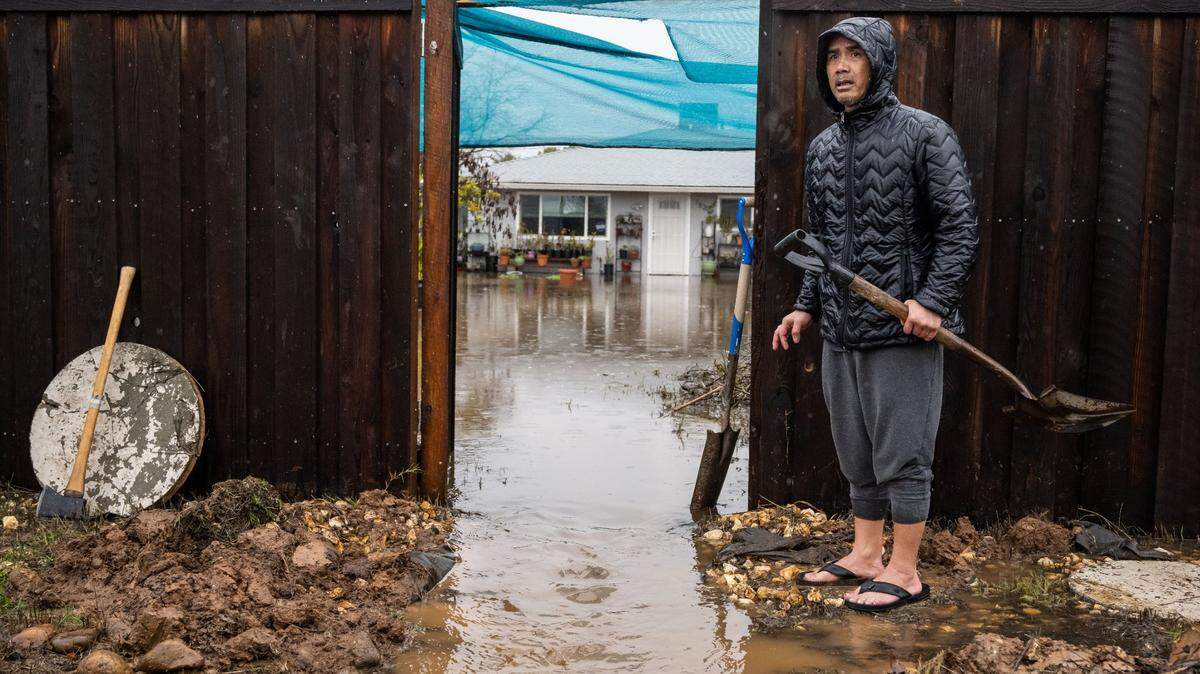
River flooding concerns
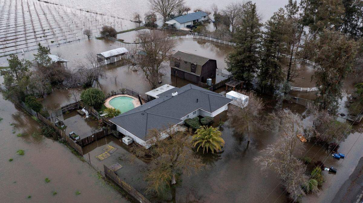
Several homes and roads near the Cosumnes River in south Sacramento County were flooded during the New Year’s Eve storm. That part of the region remains a concern as rain falling on the Sierra foothills drives downhill into the already-sogged Valley floor.
Point Pleasant, near the Cosumnes and Mokelumne rivers, remained under an evacuation order. Residents of Wilton, where two private levees failed Sunday, remained in a shelter-in-place order.
State water officials said they were confident the elaborate flood control system in the Sacramento and San Joaquin river watersheds will be able to handle the upcoming storm.
Two weirs north of Sacramento — one in Sutter County, the other in Colusa County — designed to divert water from the Sacramento River overflowed over the weekend. The weirs are expected to do the same Thursday, providing pivotal relief to the river system, Gary Lippner, deputy director of flood management and dam safety with the state Department of Water Resources, said.
However, Lippner said state water officials do not anticipate they’ll have to open the Sacramento Weir, located between the Yolo Causeway and Garden Highway about 3 miles north of downtown Sacramento.
“There is a fair amount of capacity in the system certainly to handle the forecasted flows for this week, and we continue to monitor that system very closely,” Lippner said.
Still, Lippner said “you will still see some flooding and flood impacts around Sacramento and the Sacramento River.” For example, Discovery Park, at the confluence of the American and Sacramento rivers, was already flooded Tuesday and the water “will continue to rise there,” he said.
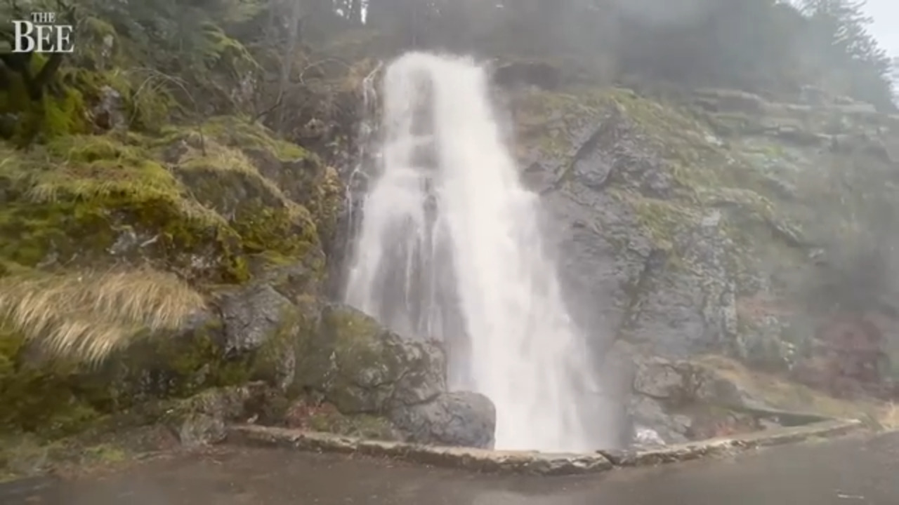
Sierra snow forecast
The National Weather Service has issued a winter storm warning for elevations above 5,000 feet, lasting from Wednesday morning through early Friday.
“Be prepared for chain controls, major travel delays, possible road closures, and periods of whiteout conditions. AVOID mountain travel if you can!” the agency tweeted.
Up to 2 feet of snow is expected above 5,000 feet and 3 feet could fall at higher peaks. Wind gusts are expected to hit 65 mph.
Snow levels could fall to around 3,500 at the start of the storm, rising to around 6,000 feet by late Wednesday before dropping again Thursday morning.
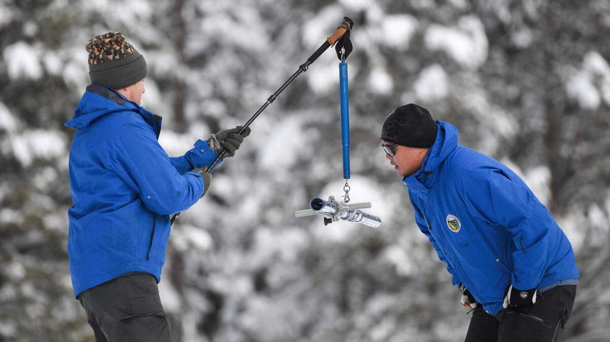
This storm is expected to be colder than the New Year’s Eve weather event. That means the Sierra snowpack — a key element of the state’s water supply — will get another boost after an already strong start to the season.
State water officials said Tuesday that the snowpack at Phillips Station along Highway 50 was at 177% of average for this time of the year. Statewide, the average snow-water equivalent is 17.1 inches — 174% of the historical average.
“While we see a terrific snowpack and that in and of itself is an opportunity to breathe a sigh of relief, we are by no means out of the woods when it comes to the drought,” state Department of Water Resources Director Karla Nemeth said.
This story was originally published January 4, 2023 at 6:53 AM.